
Magnitude |
3 |
| Date & Time (UTC) | 2014-07-11 10:15:04.2 |
| Date & Time (Local) | 1393/4/20 14:45:04.2 |
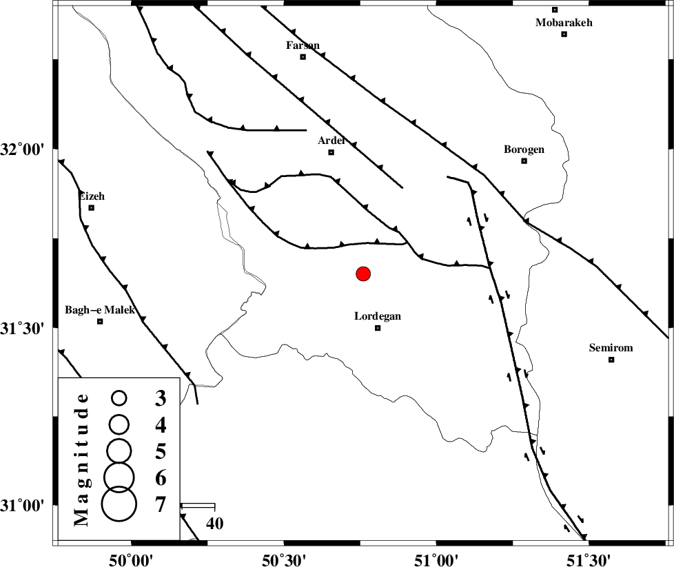
| Location | Lat:31.65 Lon: 50.76 |
| Region | Chaharmahal Bakhtiari Province, 17 km North of Lordegan |
Nearest Cities |
|
| 3 km North of Armand-e olia, Chaharmahal Bakhtiari Province | |
| 17 km North of Lordegan, Chaharmahal Bakhtiari Province | |
| 23 km East of Sarkhun, Chaharmahal Bakhtiari Province | |
| 30 km North West of Aluni, Chaharmahal Bakhtiari Province | |
| 32 km North of Sardasht, Chaharmahal Bakhtiari Province | |
| Depth | 14 km |
| Agency | |
Faults within 150 km: |
|
| SABZKUH_F (Length: 67 km) , Distance to epicenter: 10 km | |
| DOPOLAN_F (Length: 107 km) , Distance to epicenter: 16 km | |
| ARDAL_F (Length: 170 km) , Distance to epicenter: 29 km | |
| Number of Phases | 5 |
| RMS | 0.2 |
| Number of Stations | 3 |
| Error in Latitude | >6.7 km |
| Error in Longitude | 9.7 km |
| Error in Depth | 9.7 km |
Download waveform in seisan format
to download seisan software Click here
to access information about IIEES stations Click here
Amplitude | ||||||||
| UID | Agency | Station | Component | Amplitude | Period | Arrival Time | Proccessing Time | Signal Clip |
| 92780 | IIEES | ASAO | N | 46.8 | 0.72 | 2014-07-11 10:16:42 | 2014-07-11 12:54:00 | n |
Phase | ||||||||||||
| Agency | Station | Component | Phase Type | Phase Quality | First Motion | Observed Arrival Time | Time Residual | Loc. Flag | Input Weight | Distance | Azimuth | |
| IIEES | KHMZ | Z | Pg | E | 2014-07-11 10:15:43 | -0.29 | y | 244 | 342 | |||
| IIEES | GHVR | Z | Pn | E | 2014-07-11 10:15:51 | 0.22 | y | 317 | 8 | |||
| IIEES | GHVR | N | Sg | E | 2014-07-11 10:16:33 | -0.15 | y | 317 | 8 | |||
| IIEES | ASAO | Z | Pn | E | 2014-07-11 10:15:52 | 0.04 | y | 329 | 348 | |||
| IIEES | ASAO | E | Sg | E | 2014-07-11 10:16:36 | 0.22 | y | 329 | 348 | |||