
Magnitude |
2.7 |
| Date & Time (UTC) | 2014-08-07 07:42:13.8 |
| Date & Time (Local) | 1393/5/16 12:12:13.8 |
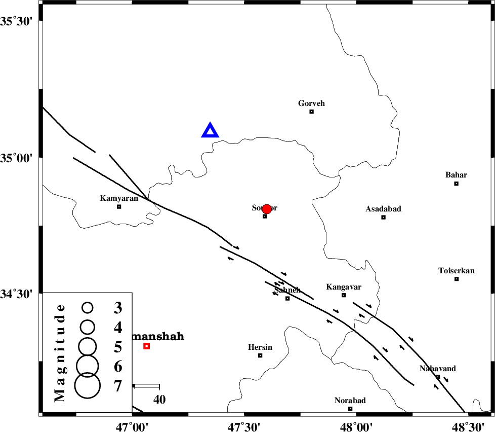
| Location | Lat:34.81 Lon: 47.6 |
| Region | Kermanshah Province, 3 km Sonqor |
Nearest Cities |
|
| 3 km North of Sonqor, Kermanshah Province | |
| 11 km North of Gaznahleh, Kermanshah Province | |
| 12 km of Qamam, Kermanshah Province | |
| 13 km West of Bavoleh, Kermanshah Province | |
| 15 km West of Abbarik-e olia, Kermanshah Province | |
| Depth | 18 km |
| Agency | |
Faults within 150 km: |
|
| SARTAKHT_F (Length: 78 km) , Distance to epicenter: 21 km | |
| DINEHVAR_F (Length: 46 km) , Distance to epicenter: 23 km | |
| SAHANEH_F (Length: 77 km) , Distance to epicenter: 30 km | |
| Number of Phases | 6 |
| RMS | 0.2 |
| Number of Stations | 6 |
| Error in Latitude | >6.2 km |
| Error in Longitude | 8 km |
| Error in Depth | 8.2 km |
Download waveform in seisan format
to download seisan software Click here
to access information about IIEES stations Click here
Amplitude | ||||||||
| UID | Agency | Station | Component | Amplitude | Period | Arrival Time | Proccessing Time | Signal Clip |
| 92916 | IIEES | ASAO | E | 41.3 | 0.43 | 2014-08-07 07:43:23 | 2014-08-07 09:47:00 | n |
| 92917 | IIEES | ASAO | N | 53.8 | 0.74 | 2014-08-07 07:43:28 | 2014-08-07 09:47:00 | n |
| 92918 | IIEES | SHGR | E | 27.3 | 0.32 | 2014-08-07 07:43:47 | 2014-08-07 09:47:00 | n |
Phase | ||||||||||||
| Agency | Station | Component | Phase Type | Phase Quality | First Motion | Observed Arrival Time | Time Residual | Loc. Flag | Input Weight | Distance | Azimuth | |
| IIEES | ASAO | Z | Pn | E | 2014-08-07 07:42:48 | -0.29 | y | 225 | 97 | |||
| IIEES | ASAO | E | Sg | E | 2014-08-07 07:43:17 | 0.04 | y | 225 | 97 | |||
| IIEES | ZNJK | Z | Pg | E | 2014-08-07 07:42:51 | 0.11 | y | 229 | 25 | |||
| IIEES | KHMZ | Z | Pn | E | 2014-08-07 07:42:52 | 0.22 | y | 248 | 118 | |||
| IIEES | CHTH | Z | P | E | 2014-08-07 07:43:03 | -0.07 | y | 343 | 68 | |||
| IIEES | GRMI | Z | Pn | E | 2014-08-07 07:43:16 | -0.03 | y | 445 | 3 | |||