
Magnitude |
3.7 |
| Date & Time (UTC) | 2014-08-18 03:53:17.7 |
| Date & Time (Local) | 1393/5/27 08:23:17.7 |
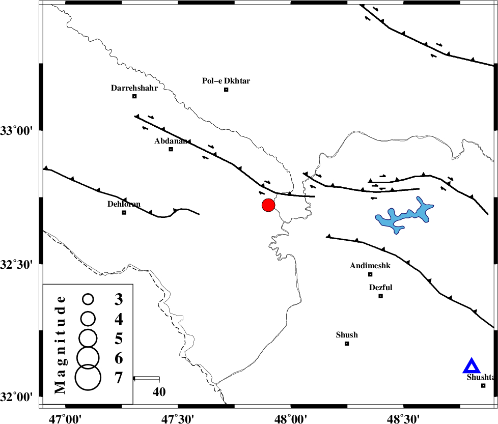
| Location | Lat:32.72 Lon: 47.9 |
| Region | Ilam Province, 52 km South-East of Pol-e dokhtar |
Nearest Cities |
|
| 32 km West of Bidruyeh, Khoozestan Province | |
| 33 km North West of Hoseinieh, Khoozestan Province | |
| 37 km South East of Sarabbagh, Ilam Province | |
| 40 km West of Sorkhakan, Khoozestan Province | |
| 46 km South East of Sarab hammam, Lorestan Province | |
| Depth | 15 km |
| Agency | |
Faults within 150 km: |
|
| BALARUD_F_Z1 (Length: 87 km) , Distance to epicenter: 6 km | |
| BALARUD_F_Z3 (Length: 53 km) , Distance to epicenter: 20 km | |
| DEZFUL_EMBAYMENT (Length: 228 km) , Distance to epicenter: 27 km | |
| Number of Phases | 6 |
| RMS | 0.3 |
| Number of Stations | 4 |
| Error in Latitude | >24.8 km |
| Error in Longitude | 15.1 km |
| Error in Depth | 30.5 km |
Download waveform in seisan format
to download seisan software Click here
to access information about IIEES stations Click here
Amplitude | ||||||||
| UID | Agency | Station | Component | Amplitude | Period | Arrival Time | Proccessing Time | Signal Clip |
| 92985 | IIEES | SNGE | N | 420.8 | 0.47 | 2014-08-18 03:54:39 | 2014-08-18 06:03:00 | n |
Phase | ||||||||||||
| Agency | Station | Component | Phase Type | Phase Quality | First Motion | Observed Arrival Time | Time Residual | Loc. Flag | Input Weight | Distance | Azimuth | |
| IIEES | SHGR | Z | Pg | E | 2014-08-18 03:53:36 | 0.33 | y | 108 | 128 | |||
| IIEES | SHGR | N | Sg | E | 2014-08-18 03:53:49 | -0.15 | y | 108 | 128 | |||
| IIEES | KHMZ | Z | Pn | E | 2014-08-18 03:53:53 | -0.17 | y | 223 | 59 | |||
| IIEES | SNGE | Z | Pn | E | 2014-08-18 03:53:58 | -0.41 | y | 269 | 349 | |||
| IIEES | SNGE | N | S | E | 2014-08-18 03:54:29 | 0.3 | y | 269 | 349 | |||
| IIEES | ASAO | Z | Pn | E | 2014-08-18 03:54:00 | 0.1 | y | 283 | 44 | |||