
Magnitude |
3 |
| Date & Time (UTC) | 2014-08-18 23:29:44.2 |
| Date & Time (Local) | 1393/5/28 03:59:44.2 |
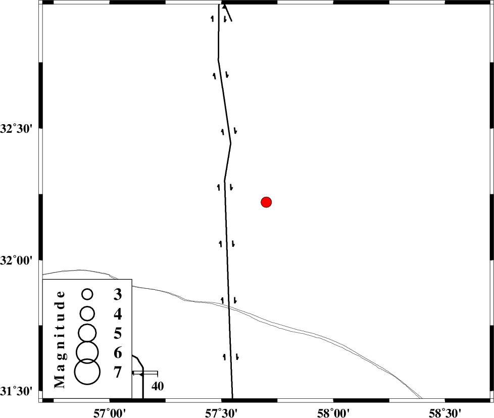
| Location | Lat:32.22 Lon: 57.7 |
| Region | Yazd Province, 135 km North-East of Ravar |
Nearest Cities |
|
| 24 km North East of Hoz-e qorban, Yazd Province | |
| 94 km South of Arababad, Yazd Province | |
| 106 km South West of Hur, Khorasan(south) Province | |
| 111 km South West of Hamand, Khorasan(south) Province | |
| 119 km South West of Bisheh bala, Khorasan(south) Province | |
| Depth | 14 km |
| Agency | |
Faults within 150 km: |
|
| NAYBAND_F (Length: 258 km) , Distance to epicenter: 20 km | |
| ESFARDIAR_F (Length: 94 km) , Distance to epicenter: 77 km | |
| LAKARKUH_F (Length: 138 km) , Distance to epicenter: 86 km | |
| Number of Phases | 4 |
| RMS | 0 |
| Number of Stations | 3 |
| Error in Latitude | >2.7 km |
| Error in Longitude | 1.4 km |
| Error in Depth | 4.4 km |
Download waveform in seisan format
to download seisan software Click here
to access information about IIEES stations Click here
Amplitude | ||||||||
| UID | Agency | Station | Component | Amplitude | Period | Arrival Time | Proccessing Time | Signal Clip |
| 93077 | IIEES | YZKH | Z | 59 | 0.24 | 2014-08-18 23:31:10 | 2014-08-19 12:48:00 | n |
Phase | ||||||||||||
| Agency | Station | Component | Phase Type | Phase Quality | First Motion | Observed Arrival Time | Time Residual | Loc. Flag | Input Weight | Distance | Azimuth | |
| IIEES | BSRN | Z | Pg | E | 2014-08-18 23:30:07 | -0.02 | y | 137 | 102 | |||
| IIEES | TABS | Z | Pg | E | 2014-08-18 23:30:11 | 0.01 | y | 167 | 341 | |||
| IIEES | YZKH | Z | Pn | E | 2014-08-18 23:30:28 | 0.06 | y | 293 | 274 | |||
| IIEES | YZKH | N | Sg | E | 2014-08-18 23:31:06 | -0.05 | y | 293 | 274 | |||