
Magnitude |
2.4 |
| Date & Time (UTC) | 2014-08-21 13:18:51.5 |
| Date & Time (Local) | 1393/5/30 17:48:51.5 |
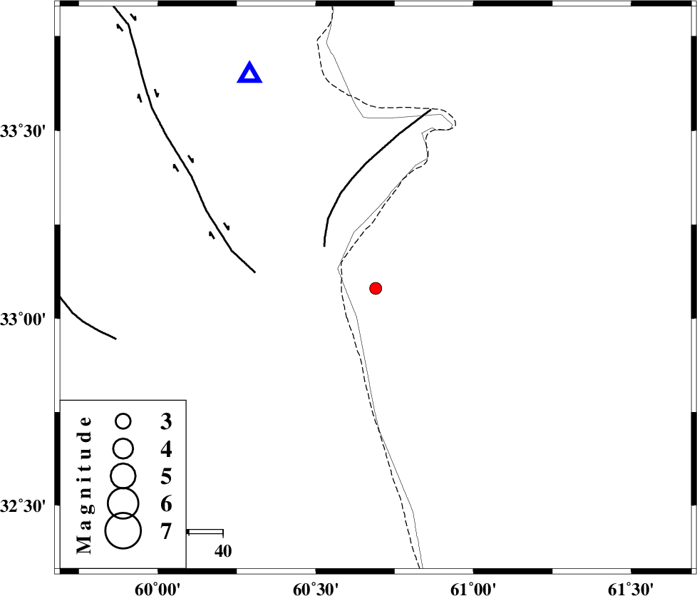
| Location | Lat:33.08 Lon: 60.69 |
| Region | 98 km North-East of Sarbisheh |
Nearest Cities |
|
| 44 km North East of Gazik, Khorasan(south) Province | |
| 52 km South West of Yazdan, Khorasan(south) Province | |
| 53 km North East of Tabas masina, Khorasan(south) Province | |
| 78 km North East of Darmian, Khorasan(south) Province | |
| 80 km South East of Shahdokht, Khorasan(south) Province | |
| Depth | 16 km |
| Agency | |
Faults within 150 km: |
|
| PATARGAN_F (Length: 52 km) , Distance to epicenter: 19 km | |
| ABRIZ_F (Length: 114 km) , Distance to epicenter: 36 km | |
| NOZAD_F (Length: 27 km) , Distance to epicenter: 78 km | |
| Number of Phases | 4 |
| RMS | 0 |
| Number of Stations | 3 |
| Error in Latitude | >3 km |
| Error in Longitude | 8.8 km |
| Error in Depth | 4.1 km |
Download waveform in seisan format
to download seisan software Click here
to access information about IIEES stations Click here
Amplitude | ||||||||
| UID | Agency | Station | Component | Amplitude | Period | Arrival Time | Proccessing Time | Signal Clip |
| 93192 | IIEES | SHRT | N | 200.2 | 0.44 | 2014-08-21 13:19:11 | 2014-08-21 02:46:00 | n |
| 93193 | IIEES | SHRT | E | 151.4 | 0.56 | 2014-08-21 13:19:12 | 2014-08-21 02:46:00 | n |
Phase | ||||||||||||
| Agency | Station | Component | Phase Type | Phase Quality | First Motion | Observed Arrival Time | Time Residual | Loc. Flag | Input Weight | Distance | Azimuth | |
| IIEES | SHRT | Z | Pg | E | 2014-08-21 13:19:04 | 0 | y | 72.7 | 329 | |||
| IIEES | BSRN | Z | Pg | E | 2014-08-21 13:19:23 | 0 | y | 192 | 230 | |||
| IIEES | BSRN | N | Sg | E | 2014-08-21 13:19:46 | 0 | y | 192 | 230 | |||
| IIEES | TABS | Z | Pn | E | 2014-08-21 13:19:41 | 0 | y | 338 | 282 | |||

 IIEES All Rights Reserved