
Magnitude |
3.2 |
| Date & Time (UTC) | 2014-08-31 22:08:46.3 |
| Date & Time (Local) | 1393/6/10 02:38:46.3 |
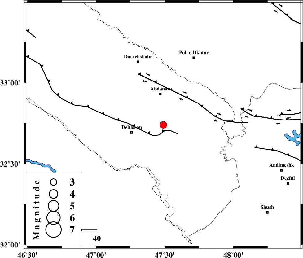
| Location | Lat:32.74 Lon: 47.49 |
| Region | Ilam Province, 22 km South of Abdanan |
Nearest Cities |
|
| 19 km South of Sarabbagh, Ilam Province | |
| 21 km South of Abdanan, Ilam Province | |
| 22 km North East of Dehloran, Ilam Province | |
| 25 km North East of Musian, Ilam Province | |
| 44 km South West of Sarab hammam, Lorestan Province | |
| Depth | 14 km |
| Agency | |
Faults within 150 km: |
|
| MFF6 (Length: 144 km) , Distance to epicenter: 4 km | |
| BALARUD_F_Z1 (Length: 87 km) , Distance to epicenter: 28 km | |
| BALARUD_F_Z3 (Length: 53 km) , Distance to epicenter: 54 km | |
| Number of Phases | 7 |
| RMS | 0.3 |
| Number of Stations | 5 |
| Error in Latitude | >3.1 km |
| Error in Longitude | 7.3 km |
| Error in Depth | 9.5 km |
Download waveform in seisan format
to download seisan software Click here
to access information about IIEES stations Click here
Amplitude | ||||||||
| UID | Agency | Station | Component | Amplitude | Period | Arrival Time | Proccessing Time | Signal Clip |
| 93420 | IIEES | SHGR | N | 342.6 | 0.69 | 2014-08-31 22:09:38 | 2014-09-01 12:57:00 | n |
| 93421 | IIEES | SNGE | N | 130 | 0.3 | 2014-08-31 22:10:12 | 2014-09-01 12:57:00 | n |
| 93422 | IIEES | ASAO | N | 69.1 | 0.53 | 2014-08-31 22:10:22 | 2014-09-01 12:57:00 | n |
| 93423 | IIEES | GHVR | E | 51.1 | 0.38 | 2014-08-31 22:10:34 | 2014-09-01 12:57:00 | n |
Phase | ||||||||||||
| Agency | Station | Component | Phase Type | Phase Quality | First Motion | Observed Arrival Time | Time Residual | Loc. Flag | Input Weight | Distance | Azimuth | |
| IIEES | SHGR | Z | Pg | E | 2014-08-31 22:09:09 | -0.32 | y | 142 | 119 | |||
| IIEES | SHGR | N | Sg | E | 2014-08-31 22:09:27 | 0.12 | y | 142 | 119 | |||
| IIEES | KHMZ | Z | Pn | E | 2014-08-31 22:09:26 | 0 | y | 256 | 64 | |||
| IIEES | SNGE | Z | Pn | E | 2014-08-31 22:09:26 | -0.28 | y | 262 | 357 | |||
| IIEES | ASAO | Z | Pn | E | 2014-08-31 22:09:33 | 0.4 | y | 309 | 49 | |||
| IIEES | ASAO | N | Sg | E | 2014-08-31 22:10:13 | -0.2 | y | 309 | 49 | |||
| IIEES | GHVR | Z | Pn | E | 2014-08-31 22:09:43 | 0.38 | y | 399 | 60 | |||