
Magnitude |
3.1 |
| Date & Time (UTC) | 2014-09-04 20:31:02.4 |
| Date & Time (Local) | 1393/6/14 01:01:02.4 |
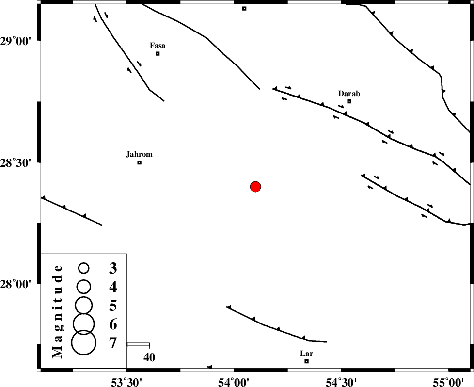
| Location | Lat:28.4 Lon: 54.1 |
| Region | Fars Province, 54 km East of Jahrom |
Nearest Cities |
|
| 10 km of Dabiran, Fars Province | |
| 26 km North West of Shahr-e pir, Fars Province | |
| 32 km North West of Hajiabad, Fars Province | |
| 33 km North East of Juyam, Fars Province | |
| 37 km East of Khorramabad, Fars Province | |
| Depth | 14 km |
| Agency | |
Faults within 150 km: |
|
| BAKHTEGAN_F (Length: 94 km) , Distance to epicenter: 45 km | |
| HZF1 (Length: 102 km) , Distance to epicenter: 46 km | |
| HZF2 (Length: 437 km) , Distance to epicenter: 48 km | |
| Number of Phases | 4 |
| RMS | 0.1 |
| Number of Stations | 3 |
| Error in Latitude | >4.1 km |
| Error in Longitude | 5.1 km |
| Error in Depth | 15.1 km |
Download waveform in seisan format
to download seisan software Click here
to access information about IIEES stations Click here
Amplitude | ||||||||
| UID | Agency | Station | Component | Amplitude | Period | Arrival Time | Proccessing Time | Signal Clip |
| 93464 | IIEES | BNDS | E | 123.5 | 0.4 | 2014-09-04 20:32:28 | 2014-09-04 09:49:00 | n |
| 93465 | IIEES | KRBR | E | 59.2 | 0.56 | 2014-09-04 20:32:36 | 2014-09-04 09:49:00 | n |
| 93466 | IIEES | KRBR | N | 65.1 | 0.56 | 2014-09-04 20:32:39 | 2014-09-04 09:49:00 | n |
Phase | ||||||||||||
| Agency | Station | Component | Phase Type | Phase Quality | First Motion | Observed Arrival Time | Time Residual | Loc. Flag | Input Weight | Distance | Azimuth | |
| IIEES | GHIR | Z | Pg | E | 2014-09-04 20:31:20 | -0.1 | y | 110 | 263 | |||
| IIEES | GHIR | E | Sg | E | 2014-09-04 20:31:34 | 0.07 | y | 110 | 263 | |||
| IIEES | BNDS | Z | Pn | E | 2014-09-04 20:31:39 | 0.01 | y | 233 | 118 | |||
| IIEES | KRBR | Z | Pn | E | 2014-09-04 20:31:49 | 0.02 | y | 313 | 55 | |||

 IIEES All Rights Reserved