
Magnitude |
4 |
| Date & Time (UTC) | 2014-09-13 19:42:45.6 |
| Date & Time (Local) | 1393/6/23 00:12:45.6 |
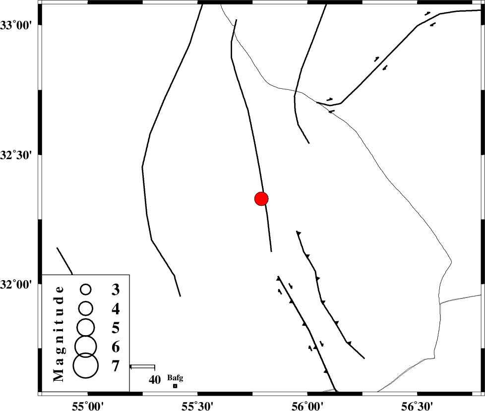
| Location | Lat:32.33 Lon: 55.79 |
| Region | Yazd Province, 89 km North-East of Bafq |
Nearest Cities |
|
| 56 km North West of Behabad, Yazd Province | |
| 66 km North of Kushk, Yazd Province | |
| 72 km North West of Benestan, Yazd Province | |
| 80 km South East of Robat-e posht-e badam, Yazd Province | |
| 84 km North West of Asfih, Yazd Province | |
| Depth | 14 km |
| Agency | |
Faults within 150 km: |
|
| SARBALA_F (Length: 92 km) , Distance to epicenter: 8 km | |
| JAFARABAD_F (Length: 60 km) , Distance to epicenter: 20 km | |
| NAINI_F (Length: 342 km) , Distance to epicenter: 31 km | |
| Number of Phases | 5 |
| RMS | 0.1 |
| Number of Stations | 5 |
| Error in Latitude | >2 km |
| Error in Longitude | 2.2 km |
| Error in Depth | 3.9 km |
Download waveform in seisan format
to download seisan software Click here
to access information about IIEES stations Click here
Amplitude | ||||||||
| UID | Agency | Station | Component | Amplitude | Period | Arrival Time | Proccessing Time | Signal Clip |
| 93531 | IIEES | YZKH | E | 1952.7 | 0.52 | 2014-09-13 19:43:22 | 2014-09-13 09:06:00 | n |
| 93532 | IIEES | TABS | N | 1803.1 | 0.48 | 2014-09-13 19:43:47 | 2014-09-13 09:06:00 | n |
| 93533 | IIEES | KRBR | N | 635.7 | 0.4 | 2014-09-13 19:44:09 | 2014-09-13 09:06:00 | n |
| 93534 | IIEES | KRBR | E | 838 | 0.6 | 2014-09-13 19:44:11 | 2014-09-13 09:06:00 | n |
| 93535 | IIEES | SHRO | E | 253 | 0.48 | 2014-09-13 19:44:48 | 2014-09-13 09:06:00 | n |
Phase | ||||||||||||
| Agency | Station | Component | Phase Type | Phase Quality | First Motion | Observed Arrival Time | Time Residual | Loc. Flag | Input Weight | Distance | Azimuth | |
| IIEES | YZKH | Z | Pg | E | 2014-09-13 19:43:04 | -0.01 | y | 113 | 273 | |||
| IIEES | TABS | Z | Pg | E | 2014-09-13 19:43:17 | -0.08 | y | 192 | 40 | |||
| IIEES | KRBR | Z | Pn | E | 2014-09-13 19:43:27 | -0.02 | y | 277 | 160 | |||
| IIEES | SHRO | E | Pn | E | 2014-09-13 19:43:44 | 0.06 | y | 408 | 3 | |||
| IIEES | SHRT | Z | Pn | E | 2014-09-13 19:43:48 | 0.08 | y | 445 | 70 | |||