
Magnitude |
3.4 |
| Date & Time (UTC) | 2014-09-17 12:35:26.5 |
| Date & Time (Local) | 1393/6/26 17:05:26.5 |
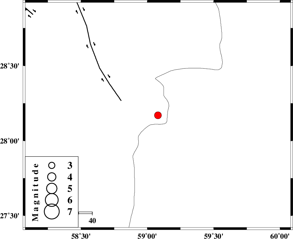
| Location | Lat:28.17 Lon: 59.08 |
| Region | Kerman Province, 138 km North-East of Kahnuj |
Nearest Cities |
|
| 58 km North East of Borj-e abbasabad, Kerman Province | |
| 59 km South of Hoseynabad, Kerman Province | |
| 64 km South East of Mohammadabad-e gonbaki, Kerman Province | |
| 80 km South East of Void, Kerman Province | |
| 87 km North West of Kalemursi, Sistan va Baloochestan Province | |
| Depth | 18 km |
| Agency | |
Faults within 150 km: |
|
| BAM_F (Length: 118 km) , Distance to epicenter: 29 km | |
| KANURAK_F (Length: 135 km) , Distance to epicenter: 101 km | |
| DAMAN_F (Length: 167 km) , Distance to epicenter: 114 km | |
| Number of Phases | 9 |
| RMS | 0.3 |
| Number of Stations | 7 |
| Error in Latitude | >3.9 km |
| Error in Longitude | 5.5 km |
| Error in Depth | 11 km |
Download waveform in seisan format
to download seisan software Click here
to access information about IIEES stations Click here
Amplitude | ||||||||
| UID | Agency | Station | Component | Amplitude | Period | Arrival Time | Proccessing Time | Signal Clip |
| 93615 | IIEES | TABS | E | 13.5 | 0.8 | 2014-09-17 12:38:37 | 2014-09-17 01:50:00 | n |
| 93616 | IIEES | TABS | N | 16.7 | 0.62 | 2014-09-17 12:38:49 | 2014-09-17 01:50:00 | n |
Phase | ||||||||||||
| Agency | Station | Component | Phase Type | Phase Quality | First Motion | Observed Arrival Time | Time Residual | Loc. Flag | Input Weight | Distance | Azimuth | |
| IIEES | ZHSF | Z | Pn | E | 2014-09-17 12:36:02 | 0.23 | y | 230 | 46 | |||
| IIEES | BNDS | Z | Pn | E | 2014-09-17 12:36:11 | 0.35 | y | 299 | 254 | |||
| IIEES | BNDS | N | Sg | E | 2014-09-17 12:36:50 | -0.2 | y | 299 | 254 | |||
| IIEES | KRBR | Z | Pn | E | 2014-09-17 12:36:11 | -0.4 | y | 302 | 312 | |||
| IIEES | KRBR | N | Sg | E | 2014-09-17 12:36:51 | 0.22 | y | 302 | 312 | |||
| IIEES | BSRN | Z | Pn | E | 2014-09-17 12:36:25 | -0.44 | y | 421 | 1 | |||
| IIEES | SHRT | Z | Pn | E | 2014-09-17 12:36:50 | -0.22 | y | 618 | 11 | |||
| IIEES | TABS | Z | Pn | E | 2014-09-17 12:36:53 | 0.17 | y | 636 | 343 | |||
| IIEES | YZKH | Z | Pn | E | 2014-09-17 12:36:53 | 0.32 | y | 636 | 318 | |||

 IIEES All Rights Reserved