
Magnitude |
3.7 |
| Date & Time (UTC) | 2014-09-22 06:26:05.9 |
| Date & Time (Local) | 1393/6/31 09:56:05.9 |
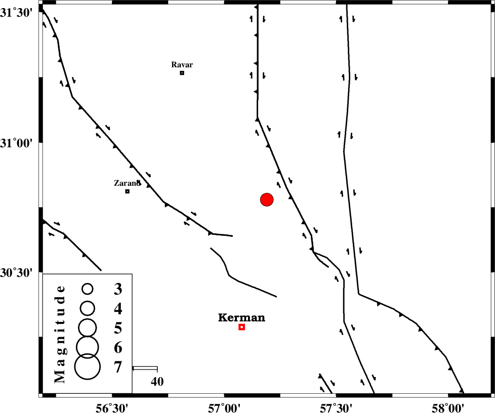
| Location | Lat:30.78 Lon: 57.19 |
| Region | Kerman Province, 55 km North-East of Kerman |
Nearest Cities |
|
| 15 km North of Harjand, Kerman Province | |
| 20 km North East of Hejdak, Kerman Province | |
| 32 km North of Dehlulu, Kerman Province | |
| 33 km North East of Hutak, Kerman Province | |
| 33 km North East of Chatrud, Kerman Province | |
| Depth | 14 km |
| Agency | |
Faults within 150 km: |
|
| LAKARKUH_F (Length: 138 km) , Distance to epicenter: 10 km | |
| KUHBANAN_F (Length: 189 km) , Distance to epicenter: 21 km | |
| GOLBAF_SIRCH_F (Length: 114 km) , Distance to epicenter: 30 km | |
| Number of Phases | 10 |
| RMS | 0.2 |
| Number of Stations | 8 |
| Error in Latitude | >1.6 km |
| Error in Longitude | 3.6 km |
| Error in Depth | 5.1 km |
Download waveform in seisan format
to download seisan software Click here
to access information about IIEES stations Click here
Amplitude | ||||||||
| UID | Agency | Station | Component | Amplitude | Period | Arrival Time | Proccessing Time | Signal Clip |
| 93661 | IIEES | BSRN | E | 512.4 | 0.66 | 2014-09-22 06:27:14 | 2014-09-22 07:07:00 | n |
Phase | ||||||||||||
| Agency | Station | Component | Phase Type | Phase Quality | First Motion | Observed Arrival Time | Time Residual | Loc. Flag | Input Weight | Distance | Azimuth | |
| IIEES | KRBR | Z | Pg | E | 2014-09-22 06:26:22 | -0.21 | y | 97.2 | 205 | |||
| IIEES | KRBR | N | Sg | E | 2014-09-22 06:26:34 | 0.01 | y | 97.2 | 205 | |||
| IIEES | BSRN | Z | Pn | E | 2014-09-22 06:26:41 | -0.36 | y | 227 | 54 | |||
| IIEES | YZKH | Z | Pn | E | 2014-09-22 06:26:51 | 0.23 | y | 304 | 307 | |||
| IIEES | TABS | Z | Pn | E | 2014-09-22 06:26:53 | 0.11 | y | 319 | 359 | |||
| IIEES | TABS | N | Sg | E | 2014-09-22 06:27:35 | -0.23 | y | 319 | 359 | |||
| IIEES | ZHSF | Z | Pn | E | 2014-09-22 06:26:59 | 0.04 | y | 369 | 110 | |||
| IIEES | BNDS | Z | Pn | E | 2014-09-22 06:27:01 | 0.12 | y | 387 | 195 | |||
| IIEES | SHRT | Z | Pn | E | 2014-09-22 06:27:07 | 0.52 | y | 432 | 42 | |||
| IIEES | GHIR | Z | Pn | E | 2014-09-22 06:27:14 | -0.08 | y | 492 | 237 | |||

 IIEES All Rights Reserved