
Magnitude |
2.2 |
| Date & Time (UTC) | 2014-10-07 10:05:00.3 |
| Date & Time (Local) | 1393/7/15 13:35:00.3 |
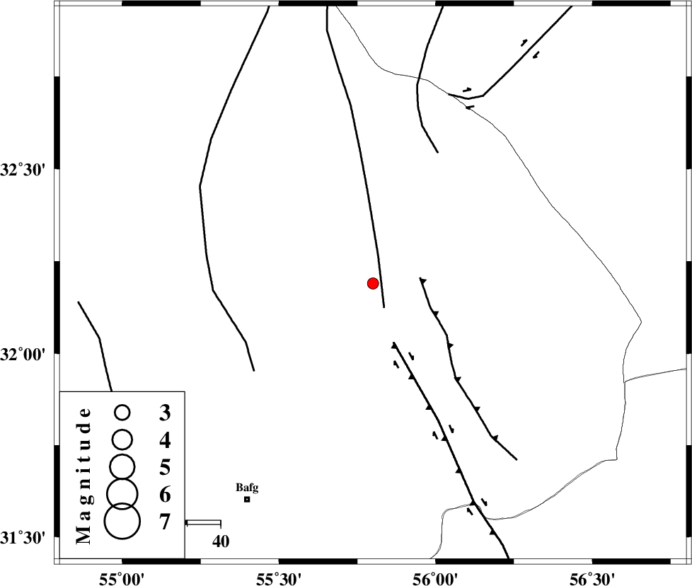
| Location | Lat:32.19 Lon: 55.8 |
| Region | Yazd Province, 75 km North-East of Bafq |
Nearest Cities |
|
| 42 km North West of Behabad, Yazd Province | |
| 50 km North of Kushk, Yazd Province | |
| 57 km North West of Benestan, Yazd Province | |
| 71 km North West of Asfih, Yazd Province | |
| 72 km North East of Mobarake, Yazd Province | |
| Depth | 17 km |
| Agency | |
Faults within 150 km: |
|
| SARBALA_F (Length: 92 km) , Distance to epicenter: 8 km | |
| JAFARABAD_F (Length: 60 km) , Distance to epicenter: 14 km | |
| KUHBANAN_F (Length: 189 km) , Distance to epicenter: 19 km | |
| Number of Phases | 5 |
| RMS | 0.1 |
| Number of Stations | 3 |
| Error in Latitude | >1.9 km |
| Error in Longitude | 2.5 km |
| Error in Depth | 5.1 km |
Download waveform in seisan format
to download seisan software Click here
to access information about IIEES stations Click here
Amplitude | ||||||||
| UID | Agency | Station | Component | Amplitude | Period | Arrival Time | Proccessing Time | Signal Clip |
| 93789 | IIEES | KRBR | N | 10.4 | 0.21 | 2014-10-07 10:06:19 | 2014-10-07 10:50:00 | n |
| 93790 | IIEES | KRBR | E | 15.3 | 0.37 | 2014-10-07 10:06:19 | 2014-10-07 10:50:00 | n |
Phase | ||||||||||||
| Agency | Station | Component | Phase Type | Phase Quality | First Motion | Observed Arrival Time | Time Residual | Loc. Flag | Input Weight | Distance | Azimuth | |
| IIEES | YZKH | Z | Pg | E | 2014-10-07 10:05:19 | -0.09 | y | 116 | 281 | |||
| IIEES | YZKH | N | Sg | E | 2014-10-07 10:05:34 | 0.07 | y | 116 | 281 | |||
| IIEES | TABS | Z | Pn | E | 2014-10-07 10:05:33 | 0.03 | y | 204 | 37 | |||
| IIEES | KRBR | Z | Pn | E | 2014-10-07 10:05:40 | -0.03 | y | 261 | 159 | |||
| IIEES | KRBR | N | Sg | E | 2014-10-07 10:06:14 | 0.03 | y | 261 | 159 | |||

 IIEES All Rights Reserved