
Magnitude |
3.7 |
| Date & Time (UTC) | 2014-10-15 16:24:38.6 |
| Date & Time (Local) | 1393/7/23 19:54:38.6 |
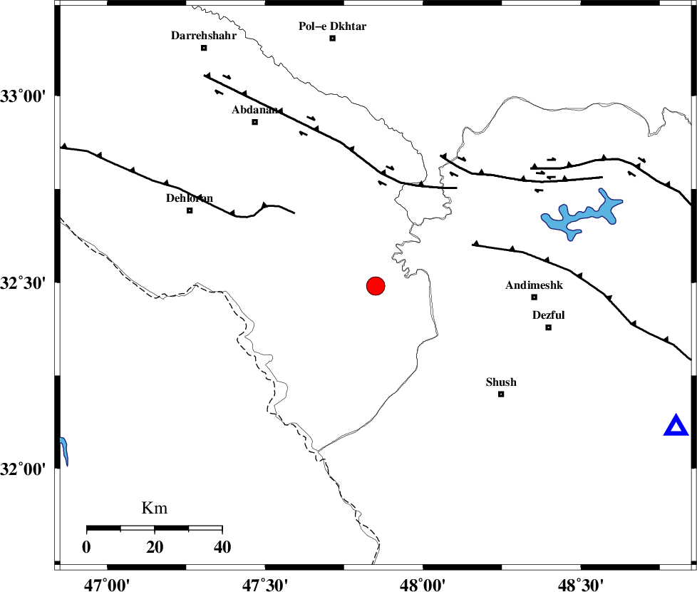
| Location | Lat:32.49 Lon: 47.85 |
| Region | Ilam Province, 47 km West of Andimeshk |
Nearest Cities |
|
| 43 km South West of Hoseinieh, Khoozestan Province | |
| 46 km East of Musian, Ilam Province | |
| 47 km South West of Bidruyeh, Khoozestan Province | |
| 47 km North West of Andimeshk, Khoozestan Province | |
| 49 km North West of Shush, Khoozestan Province | |
| Depth | 16 km |
| Agency | |
Faults within 150 km: |
|
| DEZFUL_EMBAYMENT (Length: 228 km) , Distance to epicenter: 31 km | |
| BALARUD_F_Z1 (Length: 87 km) , Distance to epicenter: 32 km | |
| MFF6 (Length: 144 km) , Distance to epicenter: 32 km | |
| Number of Phases | 9 |
| RMS | 0.1 |
| Number of Stations | 6 |
| Error in Latitude | >2.6 km |
| Error in Longitude | 1.5 km |
| Error in Depth | 2.8 km |
Download waveform in seisan format
to download seisan software Click here
to access information about IIEES stations Click here
Amplitude | ||||||||
| UID | Agency | Station | Component | Amplitude | Period | Arrival Time | Proccessing Time | Signal Clip |
| 93920 | IIEES | AHRM | E | 68.2 | 0.52 | 2014-10-15 16:27:27 | 2014-10-15 04:49:00 | n |
Phase | ||||||||||||
| Agency | Station | Component | Phase Type | Phase Quality | First Motion | Observed Arrival Time | Time Residual | Loc. Flag | Input Weight | Distance | Azimuth | |
| IIEES | KHMZ | Z | Pn | E | 2014-10-15 16:25:16 | -0.06 | y | 241 | 54 | |||
| IIEES | KHMZ | E | Sg | E | 2014-10-15 16:25:47 | 0.06 | y | 241 | 54 | |||
| IIEES | SNGE | Z | Pn | E | 2014-10-15 16:25:22 | 0.14 | y | 293 | 351 | |||
| IIEES | SNGE | N | Sg | E | 2014-10-15 16:26:01 | -0.06 | y | 293 | 351 | |||
| IIEES | ASAO | Z | Pn | E | 2014-10-15 16:25:24 | -0.08 | y | 305 | 41 | |||
| IIEES | ASAO | E | Sg | E | 2014-10-15 16:26:04 | -0.01 | y | 305 | 41 | |||
| IIEES | GHVR | Z | Pn | E | 2014-10-15 16:25:33 | -0.04 | y | 385 | 54 | |||
| IIEES | GHVR | N | S | E | 2014-10-15 16:26:14 | 0.01 | y | 385 | 54 | |||
| IIEES | CHTH | Z | Pn | E | 2014-10-15 16:25:46 | 0.03 | y | 485 | 38 | |||