
Magnitude |
4.5 |
| Date & Time (UTC) | 2014-10-15 22:31:44.1 |
| Date & Time (Local) | 1393/7/24 02:01:44.1 |
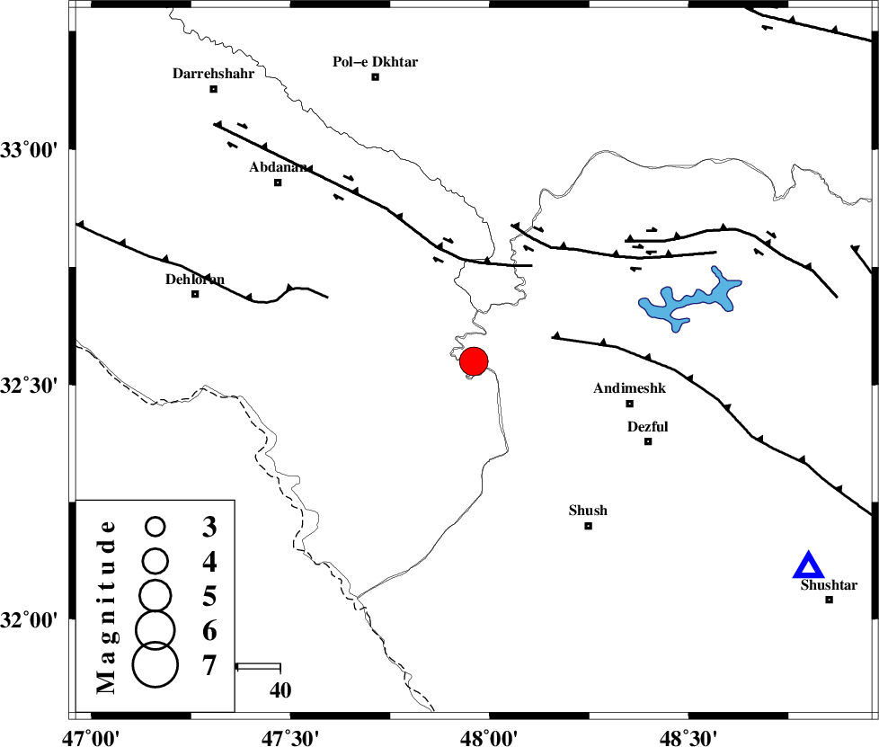
| Location | Lat:32.55 Lon: 47.96 |
| Region | Khoozestan Province, 38 km West of Andimeshk |
Nearest Cities |
|
| 31 km South West of Hoseinieh, Khoozestan Province | |
| 35 km South West of Bidruyeh, Khoozestan Province | |
| 38 km North West of Andimeshk, Khoozestan Province | |
| 43 km South West of Sorkhakan, Khoozestan Province | |
| 45 km North West of Dezful, Khoozestan Province | |
| Depth | 15 km |
| Agency | |
Faults within 150 km: |
|
| DEZFUL_EMBAYMENT (Length: 228 km) , Distance to epicenter: 19 km | |
| BALARUD_F_Z1 (Length: 87 km) , Distance to epicenter: 23 km | |
| BALARUD_F_Z3 (Length: 53 km) , Distance to epicenter: 32 km | |
| Number of Phases | 7 |
| RMS | 0.1 |
| Number of Stations | 6 |
| Error in Latitude | >2.9 km |
| Error in Longitude | 1.9 km |
| Error in Depth | 3.5 km |
Download waveform in seisan format
to download seisan software Click here
to access information about IIEES stations Click here
Amplitude | ||||||||
| UID | Agency | Station | Component | Amplitude | Period | Arrival Time | Proccessing Time | Signal Clip |
| 93931 | IIEES | AHRM | E | 472.9 | 0.6 | 2014-10-15 22:34:34 | 2014-10-15 10:55:00 | n |
| 93932 | IIEES | GHIR | E | 145.1 | 0.72 | 2014-10-15 22:35:38 | 2014-10-15 10:55:00 | n |
Phase | ||||||||||||
| Agency | Station | Component | Phase Type | Phase Quality | First Motion | Observed Arrival Time | Time Residual | Loc. Flag | Input Weight | Distance | Azimuth | |
| IIEES | KHMZ | Z | Pn | E | 2014-10-15 22:32:20 | -0.01 | y | 229 | 54 | |||
| IIEES | SNGE | Z | Pn | E | 2014-10-15 22:32:27 | -0.1 | y | 288 | 349 | |||
| IIEES | SNGE | N | Sg | E | 2014-10-15 22:33:05 | 0.06 | y | 288 | 349 | |||
| IIEES | ASAO | Z | Pn | E | 2014-10-15 22:32:28 | -0.01 | y | 293 | 40 | |||
| IIEES | ASAO | N | Sg | E | 2014-10-15 22:33:06 | -0.06 | y | 293 | 40 | |||
| IIEES | GHVR | Z | Pn | E | 2014-10-15 22:32:38 | 0.12 | y | 373 | 54 | |||
| IIEES | GHVR | N | S | E | 2014-10-15 22:33:17 | 0.01 | y | 373 | 54 | |||