
Magnitude |
3.1 |
| Date & Time (UTC) | 2014-10-18 13:23:20.6 |
| Date & Time (Local) | 1393/7/26 16:53:20.6 |
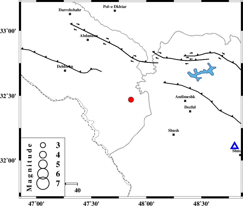
| Location | Lat:32.47 Lon: 47.86 |
| Region | Ilam Province, 46 km West of Andimeshk |
Nearest Cities |
|
| 43 km South West of Hoseinieh, Khoozestan Province | |
| 46 km North West of Andimeshk, Khoozestan Province | |
| 47 km North West of Shush, Khoozestan Province | |
| 48 km South West of Bidruyeh, Khoozestan Province | |
| 48 km East of Musian, Ilam Province | |
| Depth | 14 km |
| Agency | |
Faults within 150 km: |
|
| DEZFUL_EMBAYMENT (Length: 228 km) , Distance to epicenter: 31 km | |
| BALARUD_F_Z1 (Length: 87 km) , Distance to epicenter: 34 km | |
| MFF6 (Length: 144 km) , Distance to epicenter: 35 km | |
| Number of Phases | 6 |
| RMS | 0.2 |
| Number of Stations | 5 |
| Error in Latitude | >3 km |
| Error in Longitude | 5.3 km |
| Error in Depth | 7.2 km |
Download waveform in seisan format
to download seisan software Click here
to access information about IIEES stations Click here
Amplitude | ||||||||
| UID | Agency | Station | Component | Amplitude | Period | Arrival Time | Proccessing Time | Signal Clip |
| 93983 | IIEES | SHGR | E | 687.1 | 0.61 | 2014-10-18 13:23:58 | 2014-10-19 11:25:00 | n |
| 93984 | IIEES | SHGR | N | 738.5 | 0.22 | 2014-10-18 13:23:59 | 2014-10-19 11:25:00 | n |
| 93985 | IIEES | KHMZ | E | 90 | 0.4 | 2014-10-18 13:24:35 | 2014-10-19 11:25:00 | n |
| 93986 | IIEES | SNGE | N | 83.4 | 0.56 | 2014-10-18 13:24:54 | 2014-10-19 11:25:00 | n |
Phase | ||||||||||||
| Agency | Station | Component | Phase Type | Phase Quality | First Motion | Observed Arrival Time | Time Residual | Loc. Flag | Input Weight | Distance | Azimuth | |
| IIEES | SHGR | Z | Pg | E | 2014-10-18 13:23:37 | -0.07 | y | 97.7 | 114 | |||
| IIEES | KHMZ | Z | Pn | E | 2014-10-18 13:23:58 | 0.33 | y | 242 | 54 | |||
| IIEES | KHMZ | E | Sg | E | 2014-10-18 13:24:29 | -0.06 | y | 242 | 54 | |||
| IIEES | SNGE | Z | Pn | E | 2014-10-18 13:24:04 | -0.08 | y | 294 | 351 | |||
| IIEES | ASAO | Z | Pn | E | 2014-10-18 13:24:06 | -0.08 | y | 306 | 41 | |||
| IIEES | GHVR | Z | Pn | E | 2014-10-18 13:24:16 | -0.07 | y | 386 | 54 | |||