
Magnitude |
3.1 |
| Date & Time (UTC) | 2014-10-18 19:09:46.2 |
| Date & Time (Local) | 1393/7/26 22:39:46.2 |
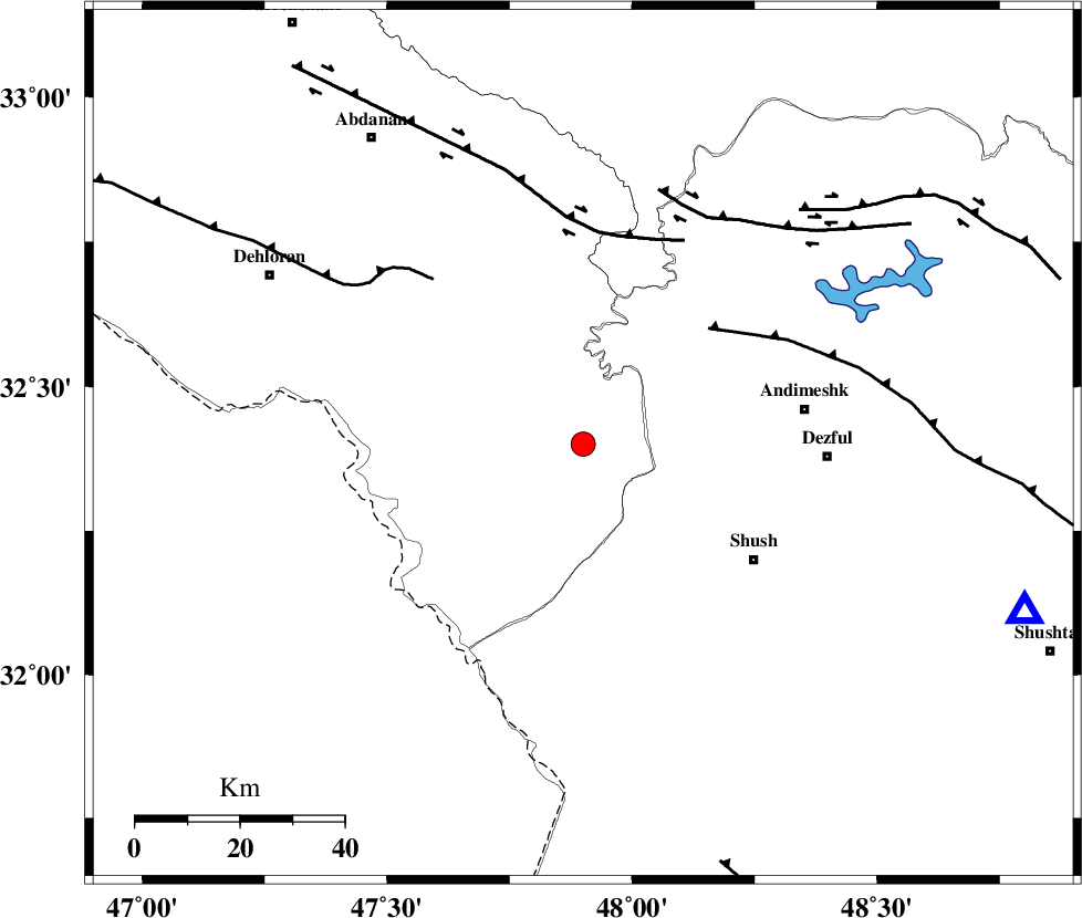
| Location | Lat:32.4 Lon: 47.9 |
| Region | Ilam Province, 43 km West of Andimeshk |
Nearest Cities |
|
| 40 km North West of Shush, Khoozestan Province | |
| 43 km West of Andimeshk, Khoozestan Province | |
| 43 km North West of Amaleh teimur, Khoozestan Province | |
| 45 km South West of Hoseinieh, Khoozestan Province | |
| 47 km North West of Dezful, Khoozestan Province | |
| Depth | 14 km |
| Agency | |
Faults within 150 km: |
|
| DEZFUL_EMBAYMENT (Length: 228 km) , Distance to epicenter: 33 km | |
| BALARUD_F_Z1 (Length: 87 km) , Distance to epicenter: 41 km | |
| MFF6 (Length: 144 km) , Distance to epicenter: 43 km | |
| Number of Phases | 8 |
| RMS | 0.3 |
| Number of Stations | 6 |
| Error in Latitude | >3.3 km |
| Error in Longitude | 6.6 km |
| Error in Depth | 9.6 km |
Download waveform in seisan format
to download seisan software Click here
to access information about IIEES stations Click here
Amplitude | ||||||||
| UID | Agency | Station | Component | Amplitude | Period | Arrival Time | Proccessing Time | Signal Clip |
| 94002 | IIEES | KHMZ | E | 112.9 | 0.84 | 2014-10-18 19:11:01 | 2014-10-19 11:25:00 | n |
Phase | ||||||||||||
| Agency | Station | Component | Phase Type | Phase Quality | First Motion | Observed Arrival Time | Time Residual | Loc. Flag | Input Weight | Distance | Azimuth | |
| IIEES | SHGR | Z | Pg | E | 2014-10-18 19:10:01 | 0.14 | y | 90.8 | 111 | |||
| IIEES | SHGR | N | Sg | E | 2014-10-18 19:10:12 | -0.16 | y | 90.8 | 111 | |||
| IIEES | KHMZ | Z | Pn | E | 2014-10-18 19:10:24 | 0.26 | y | 243 | 52 | |||
| IIEES | KHMZ | E | Sg | E | 2014-10-18 19:10:55 | 0.02 | y | 243 | 52 | |||
| IIEES | SNGE | Z | Pn | E | 2014-10-18 19:10:31 | -0.09 | y | 303 | 350 | |||
| IIEES | ASAO | Z | Pn | E | 2014-10-18 19:10:32 | -0.25 | y | 310 | 39 | |||
| IIEES | GHVR | Z | Pn | E | 2014-10-18 19:10:42 | 0.45 | y | 387 | 53 | |||
| IIEES | DAMV | Z | Pn | E | 2014-10-18 19:10:58 | -0.48 | y | 519 | 45 | |||