
Magnitude |
3.1 |
| Date & Time (UTC) | 2014-10-27 08:12:02.1 |
| Date & Time (Local) | 1393/8/5 11:42:02.1 |
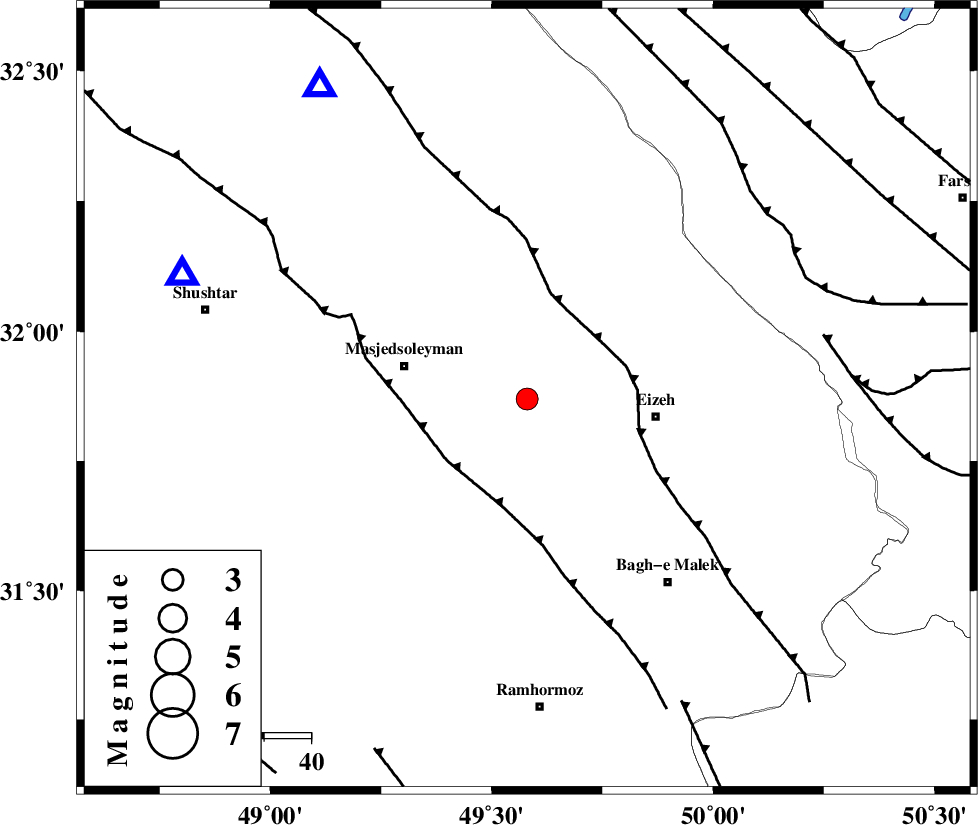
| Location | Lat:31.87 Lon: 49.58 |
| Region | Khoozestan Province, 28 km West of Izeh |
Nearest Cities |
|
| 21 km North West of Chenarestan, Khoozestan Province | |
| 22 km North West of Rasvand, Khoozestan Province | |
| 27 km East of Masjed Soleyman, Khoozestan Province | |
| 27 km South West of Torshak, Khoozestan Province | |
| 28 km North West of Izeh, Khoozestan Province | |
| Depth | 16 km |
| Agency | |
Faults within 150 km: |
|
| MFF2 (Length: 205 km) , Distance to epicenter: 20 km | |
| DEZFUL_EMBAYMENT (Length: 228 km) , Distance to epicenter: 22 km | |
| DOPOLAN_F (Length: 107 km) , Distance to epicenter: 65 km | |
| Number of Phases | 9 |
| RMS | 0.2 |
| Number of Stations | 7 |
| Error in Latitude | >2.6 km |
| Error in Longitude | 3.3 km |
| Error in Depth | 6.7 km |
Download waveform in seisan format
to download seisan software Click here
to access information about IIEES stations Click here
Amplitude | ||||||||
| UID | Agency | Station | Component | Amplitude | Period | Arrival Time | Proccessing Time | Signal Clip |
| 94095 | IIEES | KHMZ | E | 120.5 | 0.59 | 2014-10-27 08:13:04 | 2014-10-27 09:00:00 | n |
| 94096 | IIEES | AHRM | E | 39.9 | 0.17 | 2014-10-27 08:13:33 | 2014-10-27 09:00:00 | n |
| 94097 | IIEES | AHRM | N | 46 | 0.26 | 2014-10-27 08:13:33 | 2014-10-27 09:00:00 | n |
Phase | ||||||||||||
| Agency | Station | Component | Phase Type | Phase Quality | First Motion | Observed Arrival Time | Time Residual | Loc. Flag | Input Weight | Distance | Azimuth | |
| IIEES | SHGR | Z | Pg | E | 2014-10-27 08:12:15 | 0.14 | y | 77.8 | 290 | |||
| IIEES | SHGR | N | Sg | E | 2014-10-27 08:12:25 | -0.26 | y | 77.8 | 290 | |||
| IIEES | KHMZ | Z | Pn | E | 2014-10-27 08:12:36 | 0 | y | 211 | 10 | |||
| IIEES | ASAO | Z | Pn | E | 2014-10-27 08:12:47 | 0.08 | y | 300 | 8 | |||
| IIEES | ASAO | E | Sg | E | 2014-10-27 08:13:26 | 0.14 | y | 300 | 8 | |||
| IIEES | NASN | Z | Pn | E | 2014-10-27 08:12:49 | -0.48 | y | 321 | 70 | |||
| IIEES | GHVR | Z | Pn | E | 2014-10-27 08:12:50 | -0.05 | y | 329 | 28 | |||
| IIEES | AHRM | Z | Pn | E | 2014-10-27 08:12:56 | 0.26 | y | 372 | 153 | |||
| IIEES | SNGE | Z | Pn | E | 2014-10-27 08:13:01 | 0.22 | y | 413 | 331 | |||