
Magnitude |
3.4 |
| Date & Time (UTC) | 2014-10-27 20:11:21.0 |
| Date & Time (Local) | 1393/8/5 23:41:21.0 |
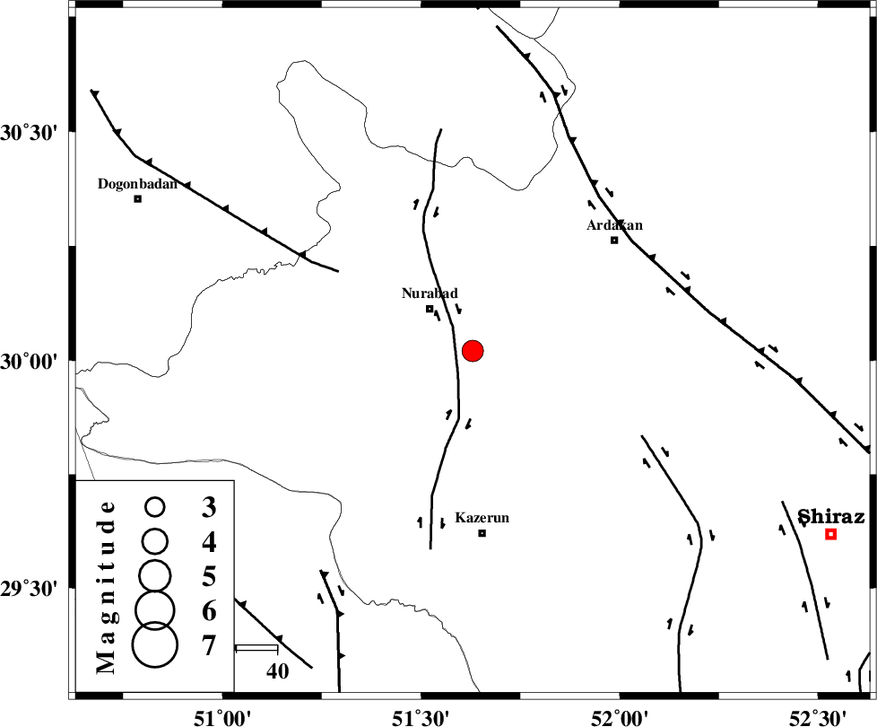
| Location | Lat:30.02 Lon: 51.63 |
| Region | Fars Province, 15 km East of Nurabad |
Nearest Cities |
|
| 12 km of Gachgaran, Fars Province | |
| 15 km East of Nurabad, Fars Province | |
| 23 km South East of Ahangari, Fars Province | |
| 24 km North of Seyyed hasan, Fars Province | |
| 25 km South East of Fahlian-e olia, Fars Province | |
| Depth | 15 km |
| Agency | |
Faults within 150 km: |
|
| KAZERUN_F (Length: 96 km) , Distance to epicenter: 7 km | |
| MISHAN_F (Length: 76 km) , Distance to epicenter: 38 km | |
| KAREBASS_F (Length: 98 km) , Distance to epicenter: 46 km | |
| Number of Phases | 5 |
| RMS | 0.2 |
| Number of Stations | 5 |
| Error in Latitude | >2.3 km |
| Error in Longitude | 2.3 km |
| Error in Depth | 0 km |
Download waveform in seisan format
to download seisan software Click here
to access information about IIEES stations Click here
Amplitude | ||||||||
| UID | Agency | Station | Component | Amplitude | Period | Arrival Time | Proccessing Time | Signal Clip |
| 94103 | IIEES | BNDS | N | 29.4 | 0.38 | 2014-10-27 20:13:30 | 2014-10-27 10:06:00 | n |
Phase | ||||||||||||
| Agency | Station | Component | Phase Type | Phase Quality | First Motion | Observed Arrival Time | Time Residual | Loc. Flag | Input Weight | Distance | Azimuth | |
| IIEES | AHRM | Z | Pn | E | 2014-10-27 20:11:44 | 0.03 | y | 132 | 194 | |||
| IIEES | NASN | Z | Pn | E | 2014-10-27 20:12:09 | -0.17 | y | 328 | 20 | |||
| IIEES | YZKH | Z | Pn | E | 2014-10-27 20:12:16 | 0.28 | y | 385 | 46 | |||
| IIEES | KRBR | Z | Pn | E | 2014-10-27 20:12:30 | -0.11 | y | 495 | 89 | |||
| IIEES | BNDS | N | Pn | E | 2014-10-27 20:12:34 | -0.05 | y | 530 | 122 | |||

 IIEES All Rights Reserved