
Magnitude |
2.4 |
| Date & Time (UTC) | 2014-12-08 22:36:37.1 |
| Date & Time (Local) | 1393/9/18 02:06:37.1 |
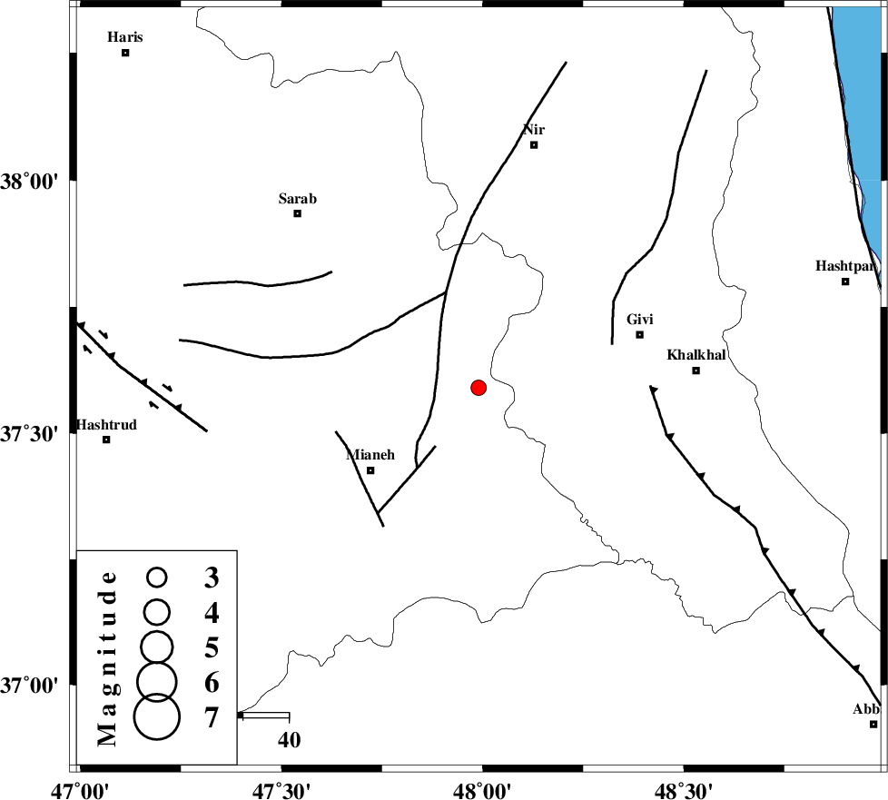
| Location | Lat:37.59 Lon: 47.99 |
| Region | Azarbaijan Sharghi Province, 30 km North-East of Mianeh |
Nearest Cities |
|
| 18 km East of Tark, Azarbaijan Sharghi Province | |
| 19 km North East of Gondoghdi, Azarbaijan Sharghi Province | |
| 20 km South of Armodaq, Azarbaijan Sharghi Province | |
| 22 km West of Firuz Abad, Ardebil Province | |
| 28 km North East of Achachi, Azarbaijan Sharghi Province | |
| Depth | 35 km |
| Agency | |
Faults within 150 km: |
|
| BOZQUSH (Length: 70 km) , Distance to epicenter: 13 km | |
| SANGAVAR_F (Length: 61 km) , Distance to epicenter: 31 km | |
| MASULEL_F (Length: 90 km) , Distance to epicenter: 38 km | |
| Number of Phases | 5 |
| RMS | 0 |
| Number of Stations | 4 |
| Error in Latitude | >1.5 km |
| Error in Longitude | 7.1 km |
| Error in Depth | 3.8 km |
Download waveform in seisan format
to download seisan software Click here
to access information about IIEES stations Click here
Amplitude | ||||||||
| UID | Agency | Station | Component | Amplitude | Period | Arrival Time | Proccessing Time | Signal Clip |
| 94481 | IIEES | ZNJK | E | 74.3 | 0.28 | 2014-12-08 22:37:14 | 2014-12-08 11:30:00 | n |
| 94482 | IIEES | CHTH | N | 11 | 0.36 | 2014-12-08 22:38:16 | 2014-12-08 11:30:00 | n |
Phase | ||||||||||||
| Agency | Station | Component | Phase Type | Phase Quality | First Motion | Observed Arrival Time | Time Residual | Loc. Flag | Input Weight | Distance | Azimuth | |
| IIEES | ZNJK | Z | Pg | E | 2014-12-08 22:36:57 | -0.07 | y | 119 | 149 | |||
| IIEES | ZNJK | E | Sg | E | 2014-12-08 22:37:12 | 0.05 | y | 119 | 149 | |||
| IIEES | GRMI | Z | Pn | E | 2014-12-08 22:36:59 | -0.01 | y | 136 | 356 | |||
| IIEES | GRMI | N | Sg | E | 2014-12-08 22:37:16 | 0.02 | y | 136 | 356 | |||
| IIEES | SNGE | Z | Pn | E | 2014-12-08 22:37:18 | 0.02 | y | 283 | 192 | |||

 IIEES All Rights Reserved