
Magnitude |
3.1 |
| Date & Time (UTC) | 2014-12-16 15:49:11.3 |
| Date & Time (Local) | 1393/9/25 19:19:11.3 |
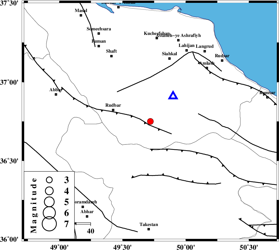
| Location | Lat:36.75 Lon: 49.72 |
| Region | Gilan Province, 27 km East of Rudbar |
Nearest Cities |
|
| 8 km North of Jirhandeh, Gilan Province | |
| 13 km South of Dashtvil, Gilan Province | |
| 20 km South West of Barresar, Gilan Province | |
| 23 km North East of Loshan, Gilan Province | |
| 24 km North West of Kelishom, Gilan Province | |
| Depth | 15 km |
| Agency | |
Faults within 150 km: |
|
| RUDBAR_F (Length: 93 km) , Distance to epicenter: 3 km | |
| ALAMUTRUD_F (Length: 140 km) , Distance to epicenter: 20 km | |
| LAHIJAN_F (Length: 92 km) , Distance to epicenter: 31 km | |
| Number of Phases | 5 |
| RMS | 0.1 |
| Number of Stations | 6 |
| Error in Latitude | >5.5 km |
| Error in Longitude | 2.3 km |
| Error in Depth | 4.1 km |
Download waveform in seisan format
to download seisan software Click here
to access information about IIEES stations Click here
Amplitude | ||||||||
| UID | Agency | Station | Component | Amplitude | Period | Arrival Time | Proccessing Time | Signal Clip |
| 94527 | IIEES | THKV | N | 318.5 | 0.12 | 2014-12-16 15:49:51 | 2014-12-16 04:16:00 | n |
Phase | ||||||||||||
| Agency | Station | Component | Phase Type | Phase Quality | First Motion | Observed Arrival Time | Time Residual | Loc. Flag | Input Weight | Distance | Azimuth | |
| IIEES | ZNJK | Z | Pg | E | 2014-12-16 15:49:27 | 0 | y | 92.4 | 265 | |||
| IIEES | CHTH | Z | Pg | E | 2014-12-16 15:49:37 | 0 | y | 157 | 126 | |||
| IIEES | DAMV | Z | Pn | E | 2014-12-16 15:49:48 | 0 | y | 238 | 121 | |||
| IIEES | ASAO | Z | Pn | E | 2014-12-16 15:49:49 | 0.11 | y | 246 | 173 | |||
| IIEES | KHMZ | Z | Pn | E | 2014-12-16 15:50:00 | -0.13 | y | 335 | 176 | |||