
Magnitude |
3.8 |
| Date & Time (UTC) | 2014-12-30 07:29:54.5 |
| Date & Time (Local) | 1393/10/9 10:59:54.5 |
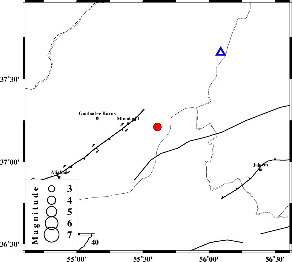
| Location | Lat:37.21 Lon: 55.61 |
| Region | Golestan Province, 20 km East of Minodasht |
Nearest Cities |
|
| 2 km of Farsian, Golestan Province | |
| 10 km North of Duzin, Golestan Province | |
| 13 km North of Rezvan, Semnan Province | |
| 17 km East of Galikesh, Golestan Province | |
| 17 km South of Aq qamish, Golestan Province | |
| Depth | 14 km |
| Agency | |
Faults within 150 km: |
|
| ROBATE_QARABIL_F (Length: 168 km) , Distance to epicenter: 18 km | |
| SHAVAR_F (Length: 87 km) , Distance to epicenter: 60 km | |
| KHAZAR_F (Length: 523 km) , Distance to epicenter: 61 km | |
| Number of Phases | 9 |
| RMS | 0.2 |
| Number of Stations | 7 |
| Error in Latitude | >2.1 km |
| Error in Longitude | 4 km |
| Error in Depth | 8.7 km |
Download waveform in seisan format
to download seisan software Click here
to access information about IIEES stations Click here
Amplitude | ||||||||
| UID | Agency | Station | Component | Amplitude | Period | Arrival Time | Proccessing Time | Signal Clip |
| 94637 | IIEES | THKV | N | 132.6 | 0.51 | 2014-12-30 07:32:05 | 2014-12-30 08:37:00 | n |
Phase | ||||||||||||
| Agency | Station | Component | Phase Type | Phase Quality | First Motion | Observed Arrival Time | Time Residual | Loc. Flag | Input Weight | Distance | Azimuth | |
| IIEES | BJRD | Z | Pg | E | 2014-12-30 07:30:21 | -0.37 | y | 168 | 71 | |||
| IIEES | BJRD | N | Sg | E | 2014-12-30 07:30:42 | 0.28 | y | 168 | 71 | |||
| IIEES | DAMV | Z | Pn | E | 2014-12-30 07:30:48 | -0.01 | y | 371 | 243 | |||
| IIEES | TABS | Z | Pn | E | 2014-12-30 07:30:54 | -0.07 | y | 418 | 160 | |||
| IIEES | TABS | N | Sg | E | 2014-12-30 07:31:51 | 0.1 | y | 418 | 160 | |||
| IIEES | THKV | Z | Pn | E | 2014-12-30 07:30:57 | 0.05 | y | 447 | 253 | |||
| IIEES | GHVR | Z | Pn | E | 2014-12-30 07:31:04 | 0.16 | y | 497 | 234 | |||
| IIEES | YZKH | Z | Pn | E | 2014-12-30 07:31:09 | -0.21 | y | 543 | 190 | |||
| IIEES | ZNJK | Z | Pn | E | 2014-12-30 07:31:19 | 0.12 | y | 620 | 267 | |||

 IIEES All Rights Reserved