
Magnitude |
2.3 |
| Date & Time (UTC) | 2015-01-02 04:56:21.0 |
| Date & Time (Local) | 1393/10/12 08:26:21.0 |
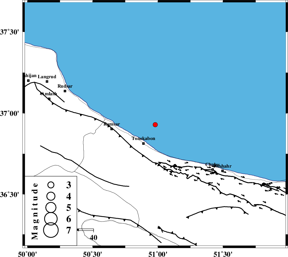
| Location | Lat:36.93 Lon: 50.98 |
| Region | Caspian Sea, 15 km North of Tonekabon |
Nearest Cities |
|
| 15 km North of Tonekabon, Mazandaran Province | |
| 18 km North of Khorramabad, Mazandaran Province | |
| 20 km North East of Soleymanabad, Mazandaran Province | |
| 23 km North of Kanza, Mazandaran Province | |
| 26 km North West of Abbasabad, Mazandaran Province | |
| Depth | 15 km |
| Agency | |
Faults within 150 km: |
|
| KHAZAR_F (Length: 523 km) , Distance to epicenter: 22 km | |
| N_ALBORZ_F (Length: 360 km) , Distance to epicenter: 26 km | |
| BONAN_F (Length: 74 km) , Distance to epicenter: 46 km | |
| Number of Phases | 7 |
| RMS | 0.1 |
| Number of Stations | 5 |
| Error in Latitude | >4.5 km |
| Error in Longitude | 5.6 km |
| Error in Depth | 5 km |
Download waveform in seisan format
to download seisan software Click here
to access information about IIEES stations Click here
Amplitude | ||||||||
| UID | Agency | Station | Component | Amplitude | Period | Arrival Time | Proccessing Time | Signal Clip |
| 94678 | IIEES | THKV | N | 140.8 | 0.52 | 2015-01-02 04:56:55 | 2015-01-02 03:58:00 | n |
| 94679 | IIEES | GHVR | E | 7.9 | 0.76 | 2015-01-02 04:57:48 | 2015-01-02 03:58:00 | n |
Phase | ||||||||||||
| Agency | Station | Component | Phase Type | Phase Quality | First Motion | Observed Arrival Time | Time Residual | Loc. Flag | Input Weight | Distance | Azimuth | |
| IIEES | THKV | Z | Pg | E | 2015-01-02 04:56:40 | 0.1 | y | 112 | 185 | |||
| IIEES | THKV | N | Sg | E | 2015-01-02 04:56:54 | 0.04 | y | 112 | 185 | |||
| IIEES | CHTH | Z | Pg | E | 2015-01-02 04:56:40 | 0.09 | y | 114 | 173 | |||
| IIEES | DAMV | Z | Pg | E | 2015-01-02 04:56:48 | -0.15 | y | 169 | 148 | |||
| IIEES | GHVR | Z | Pn | E | 2015-01-02 04:57:02 | 0.13 | y | 272 | 175 | |||
| IIEES | ASAO | Z | Pn | E | 2015-01-02 04:57:03 | -0.13 | y | 277 | 198 | |||
| IIEES | ASAO | E | Sg | E | 2015-01-02 04:57:39 | -0.09 | y | 277 | 198 | |||