
Magnitude |
1.8 |
| Date & Time (UTC) | 2015-02-07 20:37:19.4 |
| Date & Time (Local) | 1393/11/19 00:07:19.4 |
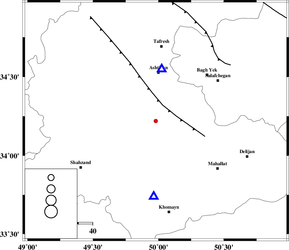
| Location | Lat:34.22 Lon: 49.98 |
| Region | Markazi Province, 35 km South of Ashtiyan |
Nearest Cities |
|
| 6 km North of Ebrahimabad, Markazi Province | |
| 13 km East of Davoodabad, Markazi Province | |
| 26 km East of Ebakabad, Markazi Province | |
| 27 km South West of Salehabad, Markazi Province | |
| 27 km North of Amanabad, Markazi Province | |
| Depth | 23 km |
| Agency | |
Faults within 150 km: |
|
| TAFRESH_F (Length: 117 km) , Distance to epicenter: 12 km | |
| INDES_F (Length: 98 km) , Distance to epicenter: 62 km | |
| MAIN_ZAGROS_R_F (Length: 1106 km) , Distance to epicenter: 108 km | |
| Number of Phases | 4 |
| RMS | 0 |
| Number of Stations | 3 |
| Error in Latitude | >3.1 km |
| Error in Longitude | 7.7 km |
| Error in Depth | 13.1 km |
Download waveform in seisan format
to download seisan software Click here
to access information about IIEES stations Click here
Amplitude | ||||||||
| UID | Agency | Station | Component | Amplitude | Period | Arrival Time | Proccessing Time | Signal Clip |
| 94987 | IIEES | ASAO | E | 76.9 | 0.48 | 2015-02-07 20:37:33 | 2015-02-08 03:26:00 | n |
| 94988 | IIEES | GHVR | E | 27 | 0.44 | 2015-02-07 20:37:58 | 2015-02-08 03:26:00 | n |
Phase | ||||||||||||
| Agency | Station | Component | Phase Type | Phase Quality | First Motion | Observed Arrival Time | Time Residual | Loc. Flag | Input Weight | Distance | Azimuth | |
| IIEES | ASAO | Z | Pg | E | 2015-02-07 20:37:26 | 0 | y | 37 | 7 | |||
| IIEES | ASAO | N | Sg | E | 2015-02-07 20:37:32 | 0 | y | 37 | 7 | |||
| IIEES | KHMZ | Z | Pg | E | 2015-02-07 20:37:29 | 0 | y | 52.9 | 182 | |||
| IIEES | GHVR | Z | P | E | 2015-02-07 20:37:39 | 0 | y | 120 | 76 | |||