
Magnitude |
2.7 |
| Date & Time (UTC) | 2015-03-03 04:11:34.6 |
| Date & Time (Local) | 1393/12/12 07:41:34.6 |
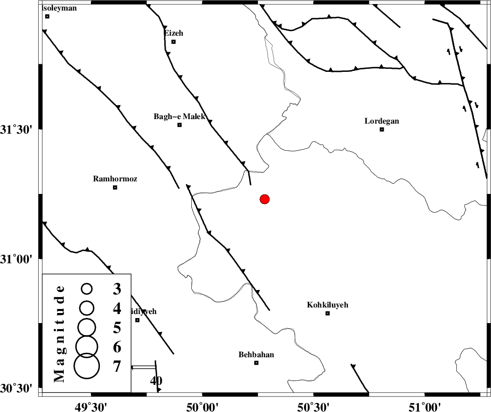
| Location | Lat:31.23 Lon: 50.28 |
| Region | Kohkiluieh va boyerahmad Province, 70 km North of Behbahan |
Nearest Cities |
|
| 6 km of Esfandan, Kohkiluieh va boyerahmad Province | |
| 13 km West of Dishmuk, Kohkiluieh va boyerahmad Province | |
| 16 km North West of Qale-ye raiesi, Kohkiluieh va boyerahmad Province | |
| 24 km South East of Seidun, Khoozestan Province | |
| 31 km North West of Lendeh, Kohkiluieh va boyerahmad Province | |
| Depth | 18 km |
| Agency | |
Faults within 150 km: |
|
| MFF2 (Length: 205 km) , Distance to epicenter: 8 km | |
| MFF4 (Length: 62 km) , Distance to epicenter: 27 km | |
| DEZFUL_EMBAYMENT (Length: 228 km) , Distance to epicenter: 37 km | |
| Number of Phases | 8 |
| RMS | 0 |
| Number of Stations | 7 |
| Error in Latitude | >9.2 km |
| Error in Longitude | 6.4 km |
| Error in Depth | 10.7 km |
Download waveform in seisan format
to download seisan software Click here
to access information about IIEES stations Click here
Amplitude | ||||||||
| UID | Agency | Station | Component | Amplitude | Period | Arrival Time | Proccessing Time | Signal Clip |
| 95150 | IIEES | SHGR | E | 105.2 | 0.43 | 2015-03-03 04:12:28 | 2015-03-03 06:09:00 | n |
| 95151 | IIEES | SNGE | E | 5.5 | 0.45 | 2015-03-03 04:13:43 | 2015-03-03 06:09:00 | n |
Phase | ||||||||||||
| Agency | Station | Component | Phase Type | Phase Quality | First Motion | Observed Arrival Time | Time Residual | Loc. Flag | Input Weight | Distance | Azimuth | |
| IIEES | SHGR | Z | Pg | E | 2015-03-03 04:12:02 | 0.01 | y | 171 | 305 | |||
| IIEES | SHGR | E | Sg | E | 2015-03-03 04:12:23 | -0.01 | y | 171 | 305 | |||
| IIEES | KHMZ | Z | P | E | 2015-03-03 04:12:16 | -0.02 | y | 280 | 354 | |||
| IIEES | NASN | Z | Pn | E | 2015-03-03 04:12:18 | -0.05 | y | 295 | 53 | |||
| IIEES | NASN | N | Sn | 2015-03-03 04:12:51 | 0 | y | 295 | 53 | ||||
| IIEES | ASAO | Z | Pn | E | 2015-03-03 04:12:27 | 0.03 | y | 369 | 356 | |||
| IIEES | GHVR | Z | Pn | E | 2015-03-03 04:12:28 | 0 | y | 372 | 14 | |||
| IIEES | SHRO | Z | Pn | E | 2015-03-03 04:13:15 | 0.11 | y | 751 | 44 | |||