
Magnitude |
1.9 |
| Date & Time (UTC) | 2015-03-04 00:04:23.9 |
| Date & Time (Local) | 1393/12/13 03:34:23.9 |
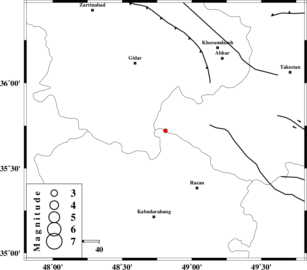
| Location | Lat:35.72 Lon: 48.81 |
| Region | Ghazvin Province, 43 km North-West of Razan |
Nearest Cities |
|
| 13 km North East of Kahla, Zanjan Province | |
| 22 km North of Khorandeh, Hamedan Province | |
| 30 km North East of Babanazar, Hamedan Province | |
| 31 km East of Zarrinabad, Zanjan Province | |
| 31 km North of Damag, Hamedan Province | |
| Depth | 17 km |
| Agency | |
Faults within 150 km: |
|
| KUSHK_E_NOSRAT_F (Length: 230 km) , Distance to epicenter: 29 km | |
| SOLTANIYEH_F (Length: 119 km) , Distance to epicenter: 43 km | |
| ZANJAN_F (Length: 137 km) , Distance to epicenter: 68 km | |
| Number of Phases | 6 |
| RMS | 0.3 |
| Number of Stations | 4 |
| Error in Latitude | >2.2 km |
| Error in Longitude | 2.8 km |
| Error in Depth | 7.7 km |
Download waveform in seisan format
to download seisan software Click here
to access information about IIEES stations Click here
Amplitude | ||||||||
| UID | Agency | Station | Component | Amplitude | Period | Arrival Time | Proccessing Time | Signal Clip |
| 95164 | IIEES | SNGE | N | 20.9 | 0.64 | 2015-03-04 00:05:08 | 2015-03-04 03:52:00 | n |
Phase | ||||||||||||
| Agency | Station | Component | Phase Type | Phase Quality | First Motion | Observed Arrival Time | Time Residual | Loc. Flag | Input Weight | Distance | Azimuth | |
| IIEES | ZNJK | Z | Pg | E | 2015-03-04 00:04:42 | 0.41 | y | 106 | 354 | |||
| IIEES | ZNJK | N | Sg | E | 2015-03-04 00:04:55 | -0.17 | y | 106 | 354 | |||
| IIEES | SNGE | Z | Pg | E | 2015-03-04 00:04:48 | -0.27 | y | 150 | 243 | |||
| IIEES | ASAO | Z | Pg | E | 2015-03-04 00:04:52 | 0.27 | y | 171 | 139 | |||
| IIEES | CHTH | Z | Pn | E | 2015-03-04 00:04:57 | 0 | y | 211 | 84 | |||
| IIEES | CHTH | E | Sg | E | 2015-03-04 00:05:23 | -0.23 | y | 211 | 84 | |||

 IIEES All Rights Reserved