
Magnitude |
3.3 |
| Date & Time (UTC) | 2015-03-15 06:24:34.2 |
| Date & Time (Local) | 1393/12/24 09:54:34.2 |
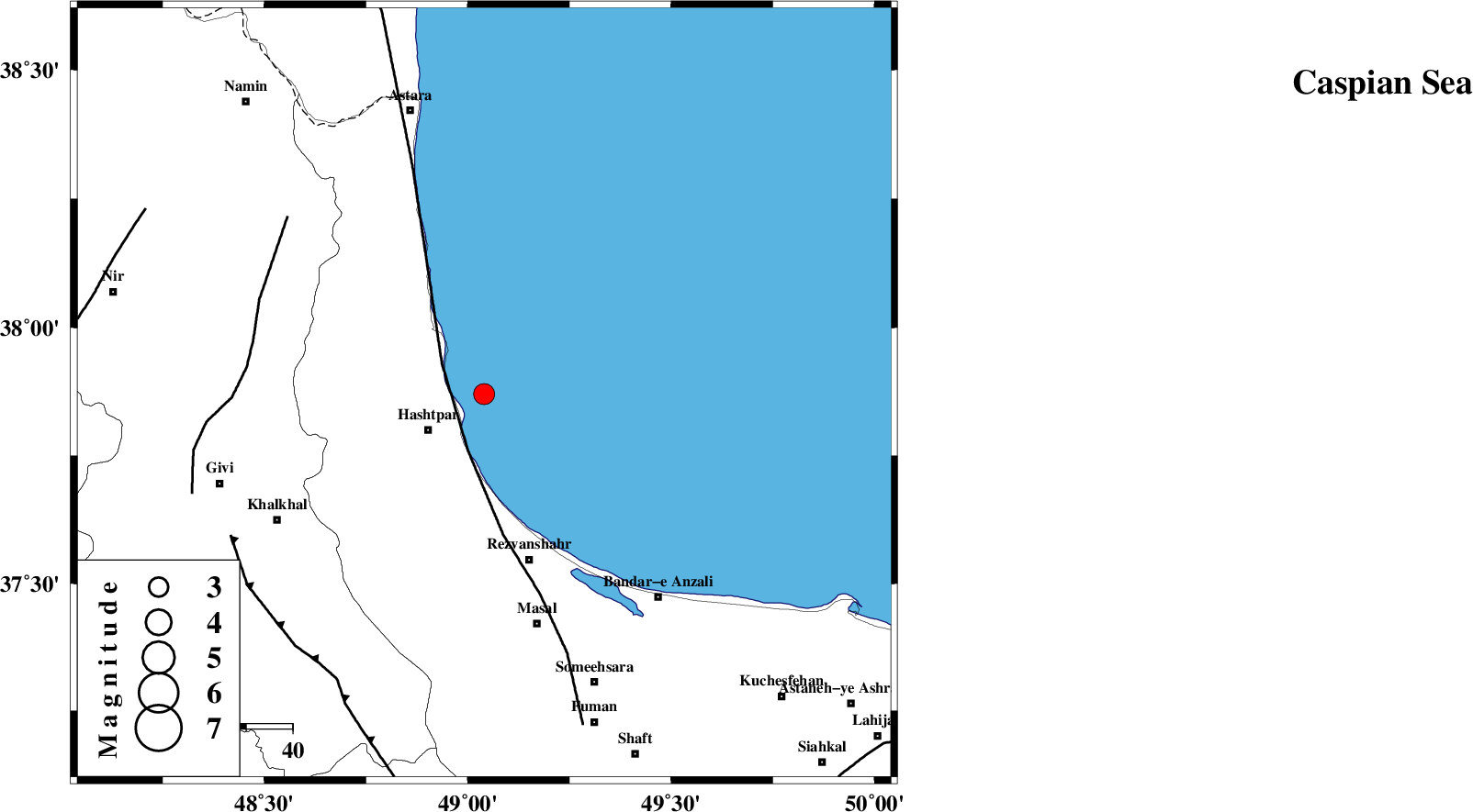
| Location | Lat:37.87 Lon: 49.04 |
| Region | Caspian Sea, 14 km East of Hashtpar |
Nearest Cities |
|
| 11 km North East of Chelonasr, Gilan Province | |
| 14 km North East of Hashtpar, Gilan Province | |
| 14 km North East of Hashtpar, Gilan Province | |
| 16 km South East of Lisar, Gilan Province | |
| 16 km North East of Tularud, Gilan Province | |
| Depth | 17 km |
| Agency | |
Faults within 150 km: |
|
| TALESH_F (Length: 258 km) , Distance to epicenter: 11 km | |
| SANGAVAR_F (Length: 61 km) , Distance to epicenter: 51 km | |
| MASULEL_F (Length: 90 km) , Distance to epicenter: 63 km | |
| Number of Phases | 6 |
| RMS | 0 |
| Number of Stations | 6 |
| Error in Latitude | >4.6 km |
| Error in Longitude | 10.2 km |
| Error in Depth | 7.8 km |
Download waveform in seisan format
to download seisan software Click here
to access information about IIEES stations Click here
Amplitude | ||||||||
| UID | Agency | Station | Component | Amplitude | Period | Arrival Time | Proccessing Time | Signal Clip |
| 95229 | IIEES | ZNJK | N | 452.9 | 0.34 | 2015-03-15 06:25:18 | 2015-03-15 07:49:00 | n |
| 95230 | IIEES | BJRD | N | 7.2 | 0.28 | 2015-03-15 06:27:23 | 2015-03-15 07:49:00 | n |
Phase | ||||||||||||
| Agency | Station | Component | Phase Type | Phase Quality | First Motion | Observed Arrival Time | Time Residual | Loc. Flag | Input Weight | Distance | Azimuth | |
| IIEES | ZNJK | Z | Pg | E | 2015-03-15 06:24:57 | 0 | y | 137 | 193 | |||
| IIEES | ZNJK | N | Sg | E | 2015-03-15 06:25:13 | 0 | y | 137 | 193 | |||
| IIEES | THKV | Z | Pn | E | 2015-03-15 06:25:15 | -0.02 | y | 272 | 142 | |||
| IIEES | CHTH | Z | Pn | E | 2015-03-15 06:25:17 | 0.05 | y | 286 | 139 | |||
| IIEES | DAMV | Z | Pn | E | 2015-03-15 06:25:26 | -0.03 | y | 361 | 133 | |||
| IIEES | ASAO | Z | Pn | E | 2015-03-15 06:25:28 | 0 | y | 379 | 166 | |||

 IIEES All Rights Reserved