
Magnitude |
2.9 |
| Date & Time (UTC) | 2015-03-30 20:21:29.4 |
| Date & Time (Local) | 1394/1/11 00:51:29.4 |
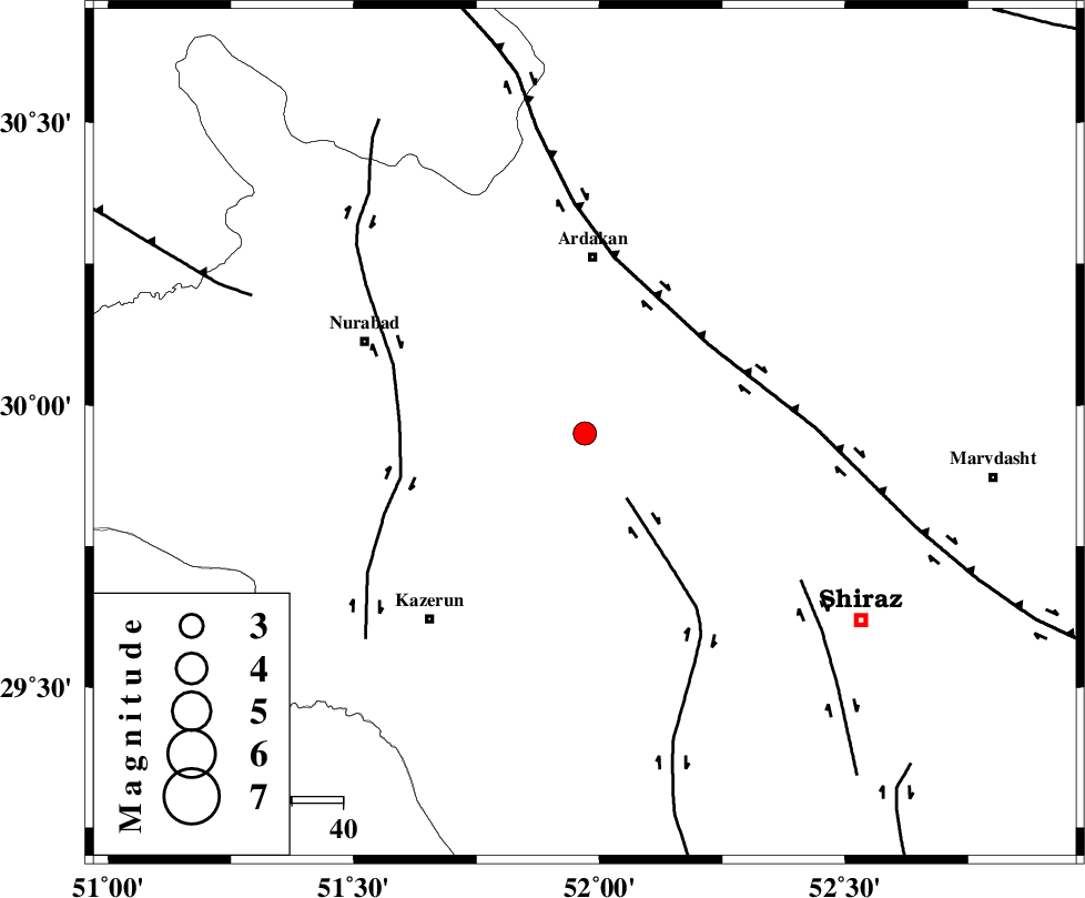
| Location | Lat:29.95 Lon: 51.97 |
| Region | Fars Province, 34 km South of Ardakan |
Nearest Cities |
|
| 30 km South of Bahrghan, Fars Province | |
| 31 km North East of Nodan, Fars Province | |
| 35 km South of Ardakan, Fars Province | |
| 37 km North East of Seyyed hasan, Fars Province | |
| 40 km North West of Khanehzanian, Fars Province | |
| Depth | 15 km |
| Agency | |
Faults within 150 km: |
|
| KAREBASS_F (Length: 98 km) , Distance to epicenter: 15 km | |
| HZF3 (Length: 197 km) , Distance to epicenter: 30 km | |
| KAZERUN_F (Length: 96 km) , Distance to epicenter: 36 km | |
| Number of Phases | 4 |
| RMS | 0.1 |
| Number of Stations | 4 |
| Error in Latitude | >2.3 km |
| Error in Longitude | 1.6 km |
| Error in Depth | 0 km |
Download waveform in seisan format
to download seisan software Click here
to access information about IIEES stations Click here
Amplitude | ||||||||
| UID | Agency | Station | Component | Amplitude | Period | Arrival Time | Proccessing Time | Signal Clip |
| 95306 | IIEES | KRBR | E | 12.7 | 0.56 | 2015-03-30 20:23:46 | 2015-03-30 10:01:00 | n |
| 95307 | IIEES | KRBR | N | 19.1 | 0.8 | 2015-03-30 20:23:52 | 2015-03-30 10:01:00 | n |
Phase | ||||||||||||
| Agency | Station | Component | Phase Type | Phase Quality | First Motion | Observed Arrival Time | Time Residual | Loc. Flag | Input Weight | Distance | Azimuth | |
| IIEES | AHRM | Z | Pn | E | 2015-03-30 20:21:54 | 0.01 | y | 137 | 209 | |||
| IIEES | NASN | Z | Pn | E | 2015-03-30 20:22:17 | -0.09 | y | 325 | 14 | |||
| IIEES | YZKH | Z | Pn | E | 2015-03-30 20:22:23 | 0.15 | y | 368 | 42 | |||
| IIEES | KRBR | Z | Pn | E | 2015-03-30 20:22:34 | -0.08 | y | 462 | 88 | |||