
Magnitude |
3 |
| Date & Time (UTC) | 2015-04-02 12:37:24.9 |
| Date & Time (Local) | 1394/1/13 17:07:24.9 |
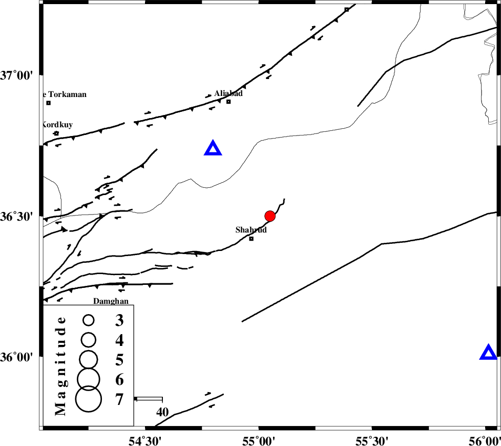
| Location | Lat:36.5 Lon: 55.05 |
| Region | Semnan Province, 12 km Shahrud |
Nearest Cities |
|
| 5 km North of Bastam, Semnan Province | |
| 12 km North of Shahrud, Semnan Province | |
| 16 km South of Qaleh-ye nokharqan, Semnan Province | |
| 17 km North of Ruyan, Semnan Province | |
| 30 km South West of Kalateh khanj, Semnan Province | |
| Depth | 14 km |
| Agency | |
Faults within 150 km: |
|
| SHAVAR_F (Length: 87 km) , Distance to epicenter: 15 km | |
| DAMGHAN_F (Length: 95 km) , Distance to epicenter: 34 km | |
| MEYAMEY_F (Length: 141 km) , Distance to epicenter: 39 km | |
| Number of Phases | 7 |
| RMS | 0.4 |
| Number of Stations | 5 |
| Error in Latitude | >8.2 km |
| Error in Longitude | 4.7 km |
| Error in Depth | 9.8 km |
Download waveform in seisan format
to download seisan software Click here
to access information about IIEES stations Click here
Amplitude | ||||||||
| UID | Agency | Station | Component | Amplitude | Period | Arrival Time | Proccessing Time | Signal Clip |
| 95312 | IIEES | DAMV | E | 60.1 | 0.52 | 2015-04-02 12:38:58 | 2015-04-02 01:30:00 | n |
| 95313 | IIEES | THKV | N | 35.5 | 0.52 | 2015-04-02 12:39:14 | 2015-04-02 01:30:00 | n |
Phase | ||||||||||||
| Agency | Station | Component | Phase Type | Phase Quality | First Motion | Observed Arrival Time | Time Residual | Loc. Flag | Input Weight | Distance | Azimuth | |
| IIEES | BJRD | N | Pn | E | 2015-04-02 12:38:03 | 0 | y | 248 | 57 | |||
| IIEES | BJRD | E | Sg | E | 2015-04-02 12:38:34 | -0.02 | y | 248 | 57 | |||
| IIEES | DAMV | Z | Pn | E | 2015-04-02 12:38:08 | -0.68 | y | 294 | 252 | |||
| IIEES | CHTH | E | Pn | E | 2015-04-02 12:38:17 | 0.02 | y | 359 | 261 | |||
| IIEES | THKV | Z | Pn | E | 2015-04-02 12:38:20 | 0.66 | y | 381 | 261 | |||
| IIEES | THKV | N | Sg | E | 2015-04-02 12:39:11 | 0.01 | y | 381 | 261 | |||
| IIEES | YZKH | Z | Pn | E | 2015-04-02 12:38:29 | 0.12 | y | 458 | 185 | |||