
Magnitude |
2.6 |
| Date & Time (UTC) | 2015-04-02 22:47:20.2 |
| Date & Time (Local) | 1394/1/14 03:17:20.2 |
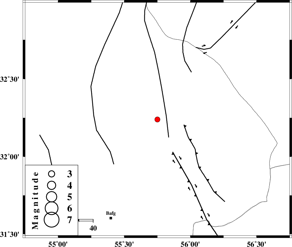
| Location | Lat:32.24 Lon: 55.75 |
| Region | Yazd Province, 78 km North-East of Bafq |
Nearest Cities |
|
| 49 km North West of Behabad, Yazd Province | |
| 56 km North of Kushk, Yazd Province | |
| 64 km North West of Benestan, Yazd Province | |
| 75 km North East of Mobarake, Yazd Province | |
| 78 km North West of Asfih, Yazd Province | |
| Depth | 31 km |
| Agency | |
Faults within 150 km: |
|
| SARBALA_F (Length: 92 km) , Distance to epicenter: 7 km | |
| JAFARABAD_F (Length: 60 km) , Distance to epicenter: 19 km | |
| KUHBANAN_F (Length: 189 km) , Distance to epicenter: 26 km | |
| Number of Phases | 6 |
| RMS | 0.2 |
| Number of Stations | 4 |
| Error in Latitude | >3.6 km |
| Error in Longitude | 4 km |
| Error in Depth | 6.5 km |
Download waveform in seisan format
to download seisan software Click here
to access information about IIEES stations Click here
Amplitude | ||||||||
| UID | Agency | Station | Component | Amplitude | Period | Arrival Time | Proccessing Time | Signal Clip |
| 95314 | IIEES | YZKH | E | 141.5 | 0.36 | 2015-04-02 22:47:54 | 2015-04-02 11:24:00 | n |
Phase | ||||||||||||
| Agency | Station | Component | Phase Type | Phase Quality | First Motion | Observed Arrival Time | Time Residual | Loc. Flag | Input Weight | Distance | Azimuth | |
| IIEES | YZKH | Z | Pg | E | 2015-04-02 22:47:39 | 0.22 | y | 110 | 279 | |||
| IIEES | YZKH | E | Sg | E | 2015-04-02 22:47:52 | 0.05 | y | 110 | 279 | |||
| IIEES | KRBR | Z | Pn | E | 2015-04-02 22:48:00 | 0.13 | y | 268 | 159 | |||
| IIEES | KRBR | N | Sg | E | 2015-04-02 22:48:34 | -0.09 | y | 268 | 159 | |||
| IIEES | NASN | E | Sg | E | 2015-04-02 22:48:38 | -0.23 | y | 283 | 283 | |||
| IIEES | BSRN | Z | Pn | E | 2015-04-02 22:48:06 | -0.09 | y | 320 | 95 | |||