
Magnitude |
2.7 |
| Date & Time (UTC) | 2015-04-06 06:56:50.4 |
| Date & Time (Local) | 1394/1/17 11:26:50.4 |
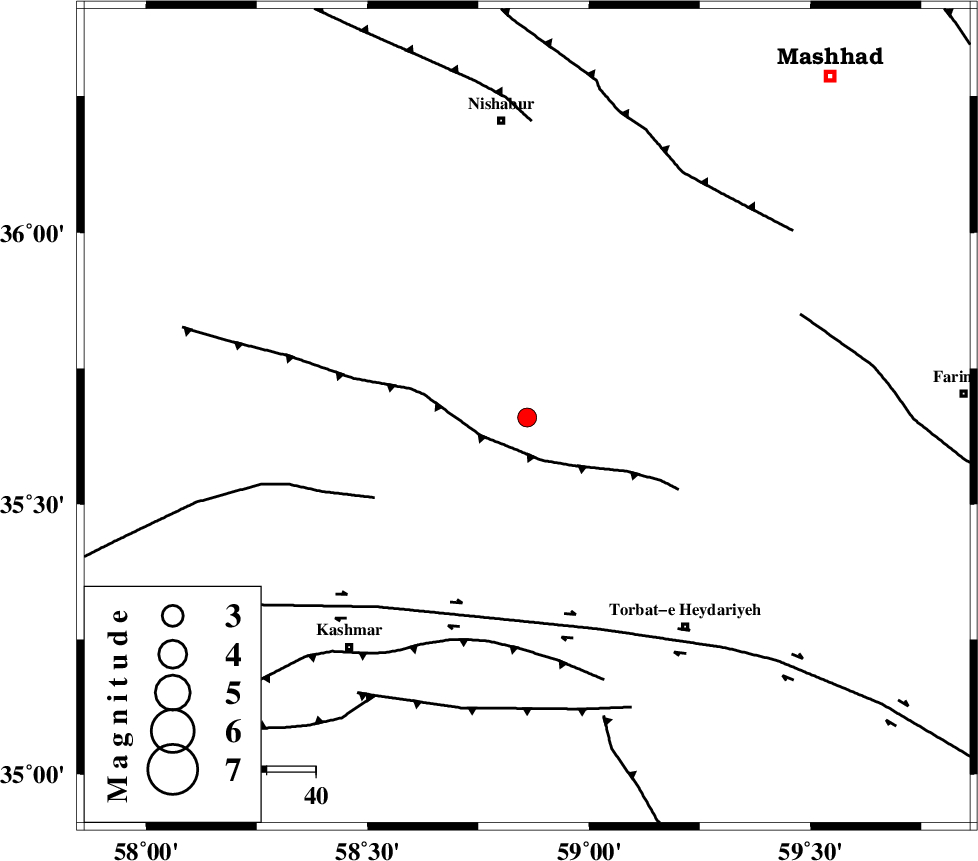
| Location | Lat:35.66 Lon: 58.86 |
| Region | Khorasan(center) Province, 60 km South of Neyshabur |
Nearest Cities |
|
| 9 km North of Kadkan, Khorasan(center) Province | |
| 11 km South of Golbu-ye sofla, Khorasan(center) Province | |
| 18 km North West of Raqicheh, Khorasan(center) Province | |
| 33 km North West of Rebatsang, Khorasan(center) Province | |
| 36 km North West of Babak, Khorasan(center) Province | |
| Depth | 14 km |
| Agency | |
Faults within 150 km: |
|
| BALHAR_F (Length: 117 km) , Distance to epicenter: 7 km | |
| BIJVARD_F (Length: 83 km) , Distance to epicenter: 35 km | |
| DORUNEH_F (Length: 713 km) , Distance to epicenter: 46 km | |
| Number of Phases | 5 |
| RMS | 0 |
| Number of Stations | 3 |
| Error in Latitude | >1.1 km |
| Error in Longitude | 3.4 km |
| Error in Depth | 5.3 km |
Download waveform in seisan format
to download seisan software Click here
to access information about IIEES stations Click here
Amplitude | ||||||||
| UID | Agency | Station | Component | Amplitude | Period | Arrival Time | Proccessing Time | Signal Clip |
| 95349 | IIEES | SHRT | N | 46.5 | 0.36 | 2015-04-06 06:58:12 | 2015-04-06 07:46:00 | n |
Phase | ||||||||||||
| Agency | Station | Component | Phase Type | Phase Quality | First Motion | Observed Arrival Time | Time Residual | Loc. Flag | Input Weight | Distance | Azimuth | |
| IIEES | SHRT | Z | Pn | E | 2015-04-06 06:57:30 | 0 | y | 259 | 149 | |||
| IIEES | BJRD | Z | Pn | E | 2015-04-06 06:57:30 | -0.05 | y | 261 | 331 | |||
| IIEES | BJRD | N | Sg | E | 2015-04-06 06:58:04 | 0.02 | y | 261 | 331 | |||
| IIEES | YZKH | Z | Pn | E | 2015-04-06 06:58:04 | 0.08 | y | 536 | 229 | |||
| IIEES | YZKH | E | Sg | E | 2015-04-06 06:59:19 | -0.04 | y | 536 | 229 | |||