
Magnitude |
2.9 |
| Date & Time (UTC) | 2015-04-14 16:55:54.4 |
| Date & Time (Local) | 1394/1/25 21:25:54.4 |
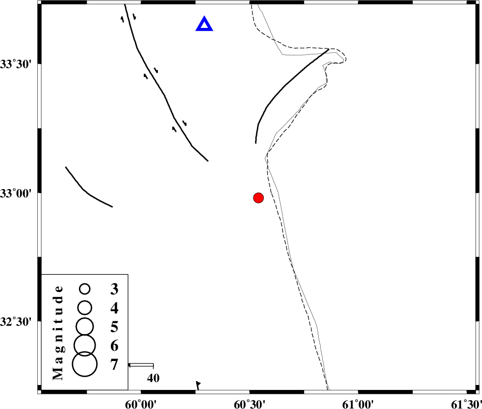
| Location | Lat:32.98 Lon: 60.54 |
| Region | Khorasan(south) Province, 80 km North-East of Sarbisheh |
Nearest Cities |
|
| 29 km East of Gazik, Khorasan(south) Province | |
| 35 km North East of Tabas masina, Khorasan(south) Province | |
| 61 km North East of Darmian, Khorasan(south) Province | |
| 68 km South West of Yazdan, Khorasan(south) Province | |
| 71 km North of Dorj, Khorasan(south) Province | |
| Depth | 26 km |
| Agency | |
Faults within 150 km: |
|
| PATARGAN_F (Length: 52 km) , Distance to epicenter: 23 km | |
| ABRIZ_F (Length: 114 km) , Distance to epicenter: 27 km | |
| NOZAD_F (Length: 27 km) , Distance to epicenter: 63 km | |
| Number of Phases | 4 |
| RMS | 0 |
| Number of Stations | 3 |
| Error in Latitude | >2 km |
| Error in Longitude | 10.6 km |
| Error in Depth | 4.9 km |
Download waveform in seisan format
to download seisan software Click here
to access information about IIEES stations Click here
Amplitude | ||||||||
| UID | Agency | Station | Component | Amplitude | Period | Arrival Time | Proccessing Time | Signal Clip |
| 95430 | IIEES | SHRT | E | 376.1 | 0.48 | 2015-04-14 16:56:18 | 2015-04-14 05:29:00 | n |
| 95431 | IIEES | BSRN | N | 163.5 | 0.48 | 2015-04-14 16:56:45 | 2015-04-14 05:29:00 | n |
Phase | ||||||||||||
| Agency | Station | Component | Phase Type | Phase Quality | First Motion | Observed Arrival Time | Time Residual | Loc. Flag | Input Weight | Distance | Azimuth | |
| IIEES | SHRT | Z | Pg | E | 2015-04-14 16:56:07 | 0 | y | 77.8 | 343 | |||
| IIEES | SHRT | N | Sg | E | 2015-04-14 16:56:17 | 0 | y | 77.8 | 343 | |||
| IIEES | BSRN | Z | Pg | E | 2015-04-14 16:56:22 | 0 | y | 174 | 230 | |||
| IIEES | YZKH | Z | Pn | E | 2015-04-14 16:57:10 | 0 | y | 561 | 265 | |||