
Magnitude |
3 |
| Date & Time (UTC) | 2015-04-19 02:30:02.7 |
| Date & Time (Local) | 1394/1/30 07:00:02.7 |
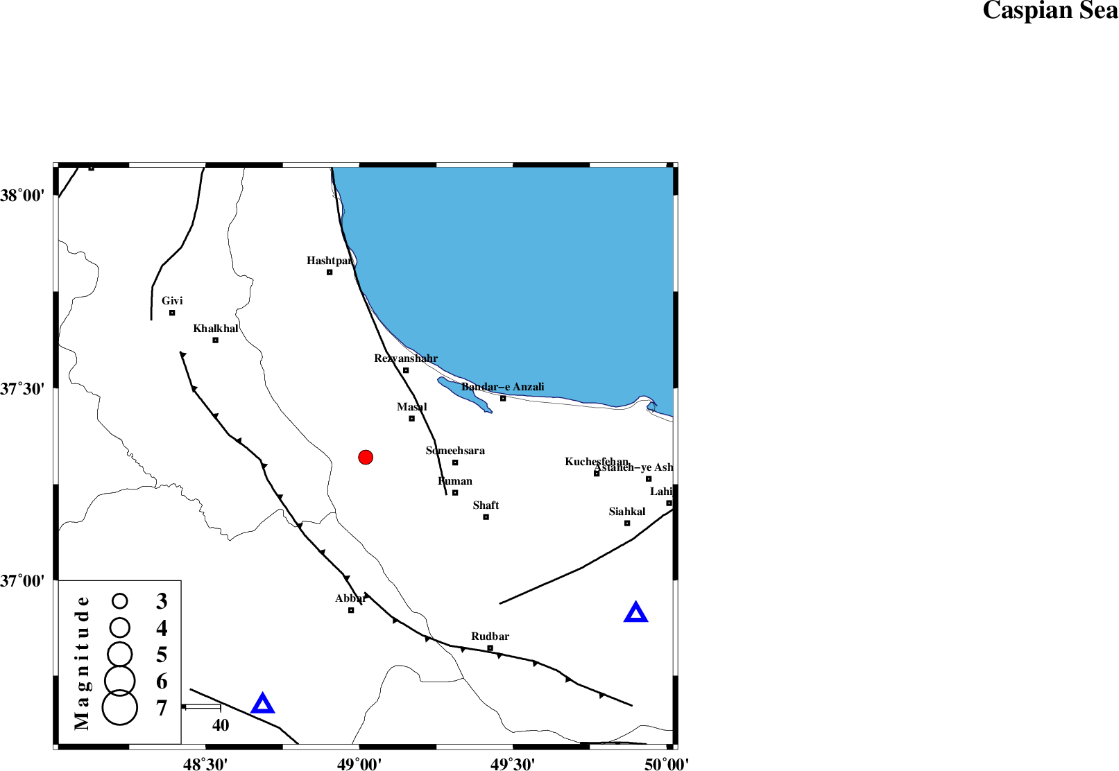
| Location | Lat:37.32 Lon: 49.02 |
| Region | Gilan Province, 17 km South-West of Masal |
Nearest Cities |
|
| 11 km West of Bazarjomeh, Gilan Province | |
| 17 km South West of Masal, Gilan Province | |
| 19 km South of Shangavar, Gilan Province | |
| 20 km East of Shal, Ardebil Province | |
| 23 km North West of Balamakolovan, Gilan Province | |
| Depth | 14 km |
| Agency | |
Faults within 150 km: |
|
| TALESH_F (Length: 258 km) , Distance to epicenter: 20 km | |
| MASULEL_F (Length: 90 km) , Distance to epicenter: 27 km | |
| RUDBAR_F (Length: 93 km) , Distance to epicenter: 39 km | |
| Number of Phases | 5 |
| RMS | 0.1 |
| Number of Stations | 4 |
| Error in Latitude | >6.6 km |
| Error in Longitude | 5.3 km |
| Error in Depth | 4.6 km |
Download waveform in seisan format
to download seisan software Click here
to access information about IIEES stations Click here
Amplitude | ||||||||
| UID | Agency | Station | Component | Amplitude | Period | Arrival Time | Proccessing Time | Signal Clip |
| 95460 | IIEES | THKV | N | 110.1 | 0.44 | 2015-04-19 02:31:12 | 2015-04-19 02:51:00 | n |
Phase | ||||||||||||
| Agency | Station | Component | Phase Type | Phase Quality | First Motion | Observed Arrival Time | Time Residual | Loc. Flag | Input Weight | Distance | Azimuth | |
| IIEES | ZNJK | Z | Pg | E | 2015-04-19 02:30:16 | -0.05 | y | 77.8 | 203 | |||
| IIEES | ZNJK | N | Sg | E | 2015-04-19 02:30:26 | 0.05 | y | 77.8 | 203 | |||
| IIEES | THKV | Z | Pg | E | 2015-04-19 02:30:39 | -0.09 | y | 228 | 133 | |||
| IIEES | CHTH | Z | Pn | E | 2015-04-19 02:30:41 | 0.17 | y | 245 | 129 | |||
| IIEES | ASAO | Z | Pn | E | 2015-04-19 02:30:50 | -0.1 | y | 320 | 163 | |||