
Magnitude |
3.8 |
| Date & Time (UTC) | 2015-04-19 03:41:18.3 |
| Date & Time (Local) | 1394/1/30 08:11:18.3 |
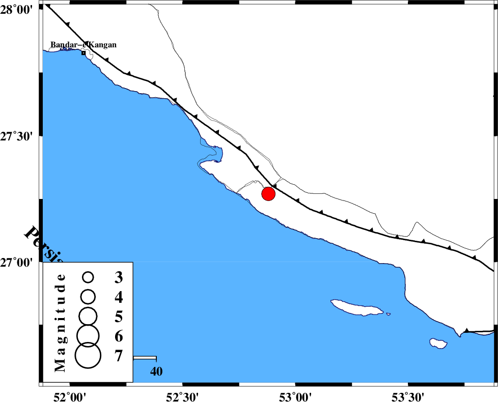
| Location | Lat:27.27 Lon: 52.88 |
| Region | Hormozgan Province, 31 km South of Mehr |
Nearest Cities |
|
| 13 km of Chah-e mobarak, Bushehr Province | |
| 22 km South of Khoozi, Fars Province | |
| 29 km West of Lamerd, Fars Province | |
| 31 km South of Mehr, Fars Province | |
| 35 km South East of Bandar-e asaluyeh, Bushehr Province | |
| Depth | 15 km |
| Agency | |
Faults within 150 km: |
|
| MFF3 (Length: 292 km) , Distance to epicenter: 4 km | |
| ZFF1 (Length: 165 km) , Distance to epicenter: 105 km | |
| LAR_F (Length: 99 km) , Distance to epicenter: 107 km | |
| Number of Phases | 4 |
| RMS | 0 |
| Number of Stations | 4 |
| Error in Latitude | >8.7 km |
| Error in Longitude | 1.4 km |
| Error in Depth | 0 km |
Download waveform in seisan format
to download seisan software Click here
to access information about IIEES stations Click here
Amplitude | ||||||||
| UID | Agency | Station | Component | Amplitude | Period | Arrival Time | Proccessing Time | Signal Clip |
| 95461 | IIEES | KRBR | N | 94.9 | 0.3 | 2015-04-19 03:43:24 | 2015-04-19 04:08:00 | n |
| 95462 | IIEES | KRBR | E | 112.4 | 0.4 | 2015-04-19 03:43:29 | 2015-04-19 04:08:00 | n |
Phase | ||||||||||||
| Agency | Station | Component | Phase Type | Phase Quality | First Motion | Observed Arrival Time | Time Residual | Loc. Flag | Input Weight | Distance | Azimuth | |
| IIEES | AHRM | Z | Pn | E | 2015-04-19 03:41:55 | 0 | y | 236 | 319 | |||
| IIEES | KRBR | Z | Pn | E | 2015-04-19 03:42:26 | 0.05 | y | 484 | 51 | |||
| IIEES | YZKH | Z | Pn | E | 2015-04-19 03:42:39 | -0.03 | y | 592 | 16 | |||
| IIEES | ZHSF | Z | Pn | E | 2015-04-19 03:43:07 | -0.05 | y | 816 | 70 | |||