
Magnitude |
2.1 |
| Date & Time (UTC) | 2015-04-28 01:36:38.5 |
| Date & Time (Local) | 1394/2/8 06:06:38.5 |
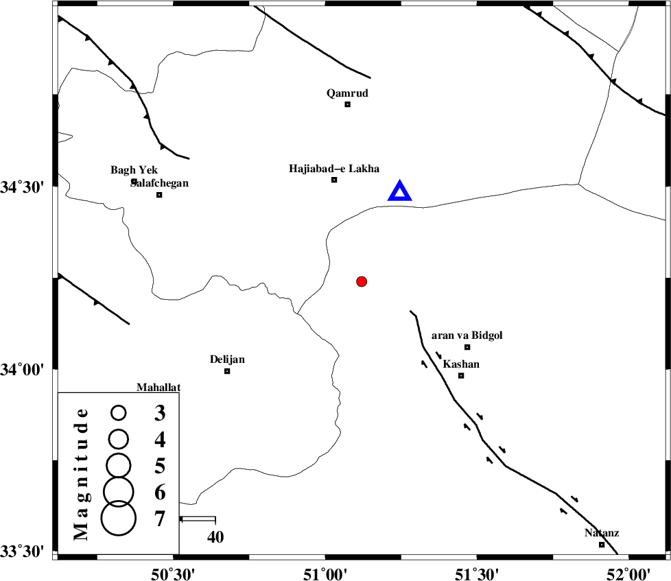
| Location | Lat:34.24 Lon: 51.12 |
| Region | Esfahan Province, 37 km North-West of Aran va bidgol |
Nearest Cities |
|
| 9 km North East of Yahyaabad, Esfahan Province | |
| 15 km North West of Mashgan, Esfahan Province | |
| 15 km North of Armak, Esfahan Province | |
| 24 km North West of Nasrabad, Esfahan Province | |
| 26 km North East of Joshaq, Markazi Province | |
| Depth | 29 km |
| Agency | |
Faults within 150 km: |
|
| KASHAN_F (Length: 44 km) , Distance to epicenter: 17 km | |
| ZEFREH_F (Length: 124 km) , Distance to epicenter: 61 km | |
| KUSHK_E_NOSRAT_F (Length: 230 km) , Distance to epicenter: 62 km | |
| Number of Phases | 5 |
| RMS | 0 |
| Number of Stations | 4 |
| Error in Latitude | >3.1 km |
| Error in Longitude | 3.9 km |
| Error in Depth | 2.8 km |
Download waveform in seisan format
to download seisan software Click here
to access information about IIEES stations Click here
Amplitude | ||||||||
| UID | Agency | Station | Component | Amplitude | Period | Arrival Time | Proccessing Time | Signal Clip |
| 95528 | IIEES | KHMZ | Z | 42.9 | 0.24 | 2015-04-28 01:37:16 | 2015-04-28 03:57:00 | n |
Phase | ||||||||||||
| Agency | Station | Component | Phase Type | Phase Quality | First Motion | Observed Arrival Time | Time Residual | Loc. Flag | Input Weight | Distance | Azimuth | |
| IIEES | ASAO | Z | Pg | E | 2015-04-28 01:36:56 | 0.01 | y | 107 | 289 | |||
| IIEES | KHMZ | Z | Pg | E | 2015-04-28 01:36:58 | -0.01 | y | 120 | 243 | |||
| IIEES | DAMV | Z | Pn | E | 2015-04-28 01:37:06 | 0.02 | y | 173 | 26 | |||
| IIEES | DAMV | Z | Sg | E | 2015-04-28 01:37:27 | 0 | y | 173 | 26 | |||
| IIEES | CHTH | Z | Pn | E | 2015-04-28 01:37:08 | -0.02 | y | 185 | 0 | |||