
Magnitude |
2 |
| Date & Time (UTC) | 2015-04-30 09:43:18.4 |
| Date & Time (Local) | 1394/2/10 14:13:18.4 |
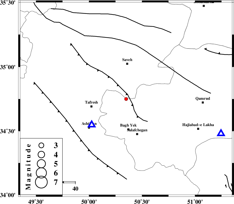
| Location | Lat:34.75 Lon: 50.35 |
| Region | Qom Province, 30 km South of Saveh |
Nearest Cities |
|
| 17 km West of Gazran, Qom Province | |
| 17 km South of Qareh chay, Markazi Province | |
| 22 km South of Yalabad, Markazi Province | |
| 24 km North East of Dastjerd, Qom Province | |
| 26 km North of Bagh yek, Qom Province | |
| Depth | 23 km |
| Agency | |
Faults within 150 km: |
|
| INDES_F (Length: 98 km) , Distance to epicenter: 4 km | |
| KUSHK_E_NOSRAT_F (Length: 230 km) , Distance to epicenter: 44 km | |
| TAFRESH_F (Length: 117 km) , Distance to epicenter: 53 km | |
| Number of Phases | 4 |
| RMS | 0 |
| Number of Stations | 3 |
| Error in Latitude | >7.3 km |
| Error in Longitude | 4.5 km |
| Error in Depth | 7.9 km |
Download waveform in seisan format
to download seisan software Click here
to access information about IIEES stations Click here
Amplitude | ||||||||
| UID | Agency | Station | Component | Amplitude | Period | Arrival Time | Proccessing Time | Signal Clip |
| 95543 | IIEES | ASAO | E | 149.9 | 0.56 | 2015-04-30 09:43:32 | 2015-04-30 02:40:00 | n |
Phase | ||||||||||||
| Agency | Station | Component | Phase Type | Phase Quality | First Motion | Observed Arrival Time | Time Residual | Loc. Flag | Input Weight | Distance | Azimuth | |
| IIEES | ASAO | Z | Pg | E | 2015-04-30 09:43:26 | 0 | y | 37.5 | 233 | |||
| IIEES | ASAO | N | Sg | E | 2015-04-30 09:43:31 | 0 | y | 37.5 | 233 | |||
| IIEES | GHVR | Z | Pg | E | 2015-04-30 09:43:33 | 0 | y | 87.4 | 110 | |||
| IIEES | KHMZ | Z | Pg | E | 2015-04-30 09:43:38 | 0 | y | 118 | 198 | |||