
Magnitude |
4.1 |
| Date & Time (UTC) | 2015-05-10 02:02:55.3 |
| Date & Time (Local) | 1394/2/20 06:32:55.3 |
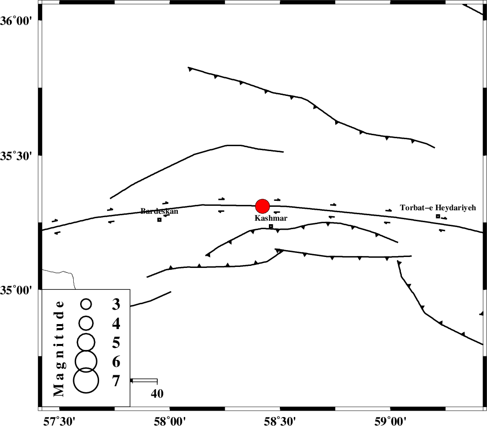
| Location | Lat:35.31 Lon: 58.42 |
| Region | Khorasan(center) Province, 9 km Kashmar |
Nearest Cities |
|
| 6 km North of Kasrineh, Khorasan(center) Province | |
| 9 km North of Kashmar, Khorasan(center) Province | |
| 11 km North East of Khalilabad, Khorasan(center) Province | |
| 18 km South of Rivash, Khorasan(center) Province | |
| 18 km South of Toroq, Khorasan(center) Province | |
| Depth | 15 km |
| Agency | |
Faults within 150 km: |
|
| KASHMAR_F (Length: 91 km) , Distance to epicenter: 9 km | |
| DORUNEH_F (Length: 713 km) , Distance to epicenter: 9 km | |
| DUGHABAD_F (Length: 62 km) , Distance to epicenter: 18 km | |
| Number of Phases | 4 |
| RMS | 0 |
| Number of Stations | 5 |
| Error in Latitude | >2.4 km |
| Error in Longitude | 1.2 km |
| Error in Depth | 0 km |
Download waveform in seisan format
to download seisan software Click here
to access information about IIEES stations Click here
Amplitude | ||||||||
| UID | Agency | Station | Component | Amplitude | Period | Arrival Time | Proccessing Time | Signal Clip |
| 95623 | IIEES | SHRT | N | 579.9 | 0.32 | 2015-05-10 02:04:13 | 2015-05-10 03:27:00 | n |
| 95624 | IIEES | SHRT | E | 534.4 | 0.32 | 2015-05-10 02:04:20 | 2015-05-10 03:27:00 | n |
| 95625 | IIEES | YZKH | N | 214.9 | 0.48 | 2015-05-10 02:05:22 | 2015-05-10 03:27:00 | n |
| 95626 | IIEES | YZKH | E | 304.7 | 0.36 | 2015-05-10 02:05:24 | 2015-05-10 03:27:00 | n |
| 95627 | IIEES | KRBR | N | 148.8 | 0.68 | 2015-05-10 02:05:59 | 2015-05-10 03:27:00 | n |
| 95628 | IIEES | KRBR | E | 78.2 | 0.56 | 2015-05-10 02:06:09 | 2015-05-10 03:27:00 | n |
Phase | ||||||||||||
| Agency | Station | Component | Phase Type | Phase Quality | First Motion | Observed Arrival Time | Time Residual | Loc. Flag | Input Weight | Distance | Azimuth | |
| IIEES | SHRO | Z | Pn | E | 2015-05-10 02:03:31 | 0.04 | y | 231 | 290 | |||
| IIEES | SHRT | Z | Pn | E | 2015-05-10 02:03:34 | 0.01 | y | 252 | 136 | |||
| IIEES | MRVT | Z | Pn | E | 2015-05-10 02:03:44 | -0.03 | y | 334 | 322 | |||
| IIEES | YZKH | Z | Pn | E | 2015-05-10 02:04:02 | -0.03 | y | 480 | 229 | |||