
Magnitude |
3.2 |
| Date & Time (UTC) | 2015-06-07 22:47:18.3 |
| Date & Time (Local) | 1394/3/18 03:17:18.3 |
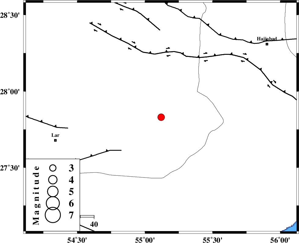
| Location | Lat:27.83 Lon: 55.12 |
| Region | Fars Province, 78 km North-East of Lar |
Nearest Cities |
|
| 30 km West of Darz, Fars Province | |
| 42 km South of Fadami, Fars Province | |
| 54 km South of Doborji, Fars Province | |
| 69 km East of Dehkuyeh, Fars Province | |
| 69 km South of Rostaq, Fars Province | |
| Depth | 14 km |
| Agency | |
Faults within 150 km: |
|
| LAR_F (Length: 99 km) , Distance to epicenter: 38 km | |
| HZF2 (Length: 437 km) , Distance to epicenter: 46 km | |
| HZF1 (Length: 102 km) , Distance to epicenter: 63 km | |
| Number of Phases | 5 |
| RMS | 0 |
| Number of Stations | 3 |
| Error in Latitude | >1.4 km |
| Error in Longitude | 4.2 km |
| Error in Depth | 5.8 km |
Download waveform in seisan format
to download seisan software Click here
to access information about IIEES stations Click here
Amplitude | ||||||||
| UID | Agency | Station | Component | Amplitude | Period | Arrival Time | Proccessing Time | Signal Clip |
| 95899 | IIEES | BNDS | N | 565.8 | 0.48 | 2015-06-07 22:47:58 | 2015-06-08 12:58:00 | n |
Phase | ||||||||||||
| Agency | Station | Component | Phase Type | Phase Quality | First Motion | Observed Arrival Time | Time Residual | Loc. Flag | Input Weight | Distance | Azimuth | |
| IIEES | BNDS | Z | Pg | E | 2015-06-07 22:47:37 | -0.01 | y | 115 | 115 | |||
| IIEES | BNDS | N | Sg | E | 2015-06-07 22:47:51 | 0.01 | y | 115 | 115 | |||
| IIEES | KRBR | Z | Pn | E | 2015-06-07 22:48:01 | 0.03 | y | 287 | 34 | |||
| IIEES | KRBR | N | Sg | E | 2015-06-07 22:48:39 | -0.01 | y | 287 | 34 | |||
| IIEES | YZKH | Z | Pn | E | 2015-06-07 22:48:29 | -0.01 | y | 508 | 354 | |||