Home / Recent Earthquakes

| Prel. Rep. | Date | Time(UTC) | Time(Local) | Lat. | Lon. | Depth | Mag. | Region | Waveform |
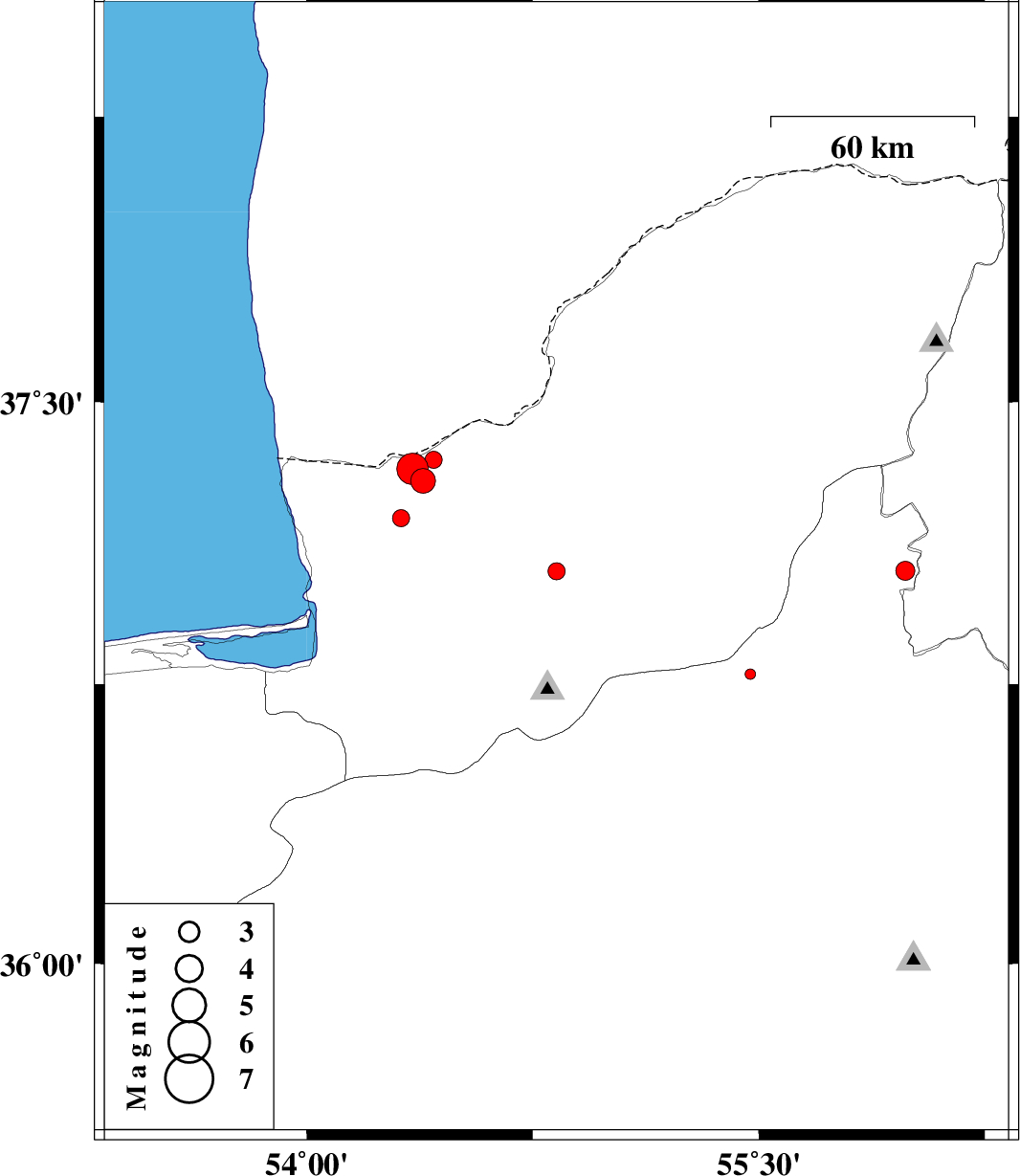
| 2015/09/21 | 05:33:11.0 | 10:03:11.0 | 37.051 | 54.829 | 17 | ML:2.6 | Golestan Province, 17 km North of Ali Abad | ||
| 2015/09/19 | 08:03:14.0 | 12:33:14.0 | 37.052 | 55.987 | 15 | ML:2.8 | Semnan Province, 37 km North-West of Jajarm | ||
| 2015/09/19 | 00:53:21.6 | 05:23:21.6 | 37.192 | 54.313 | 14 | ML:2.6 | Golestan Province, 24 km North-West of Aq Qaleh | ||
| 2015/09/18 | 15:56:21.6 | 20:26:21.6 | 37.29 | 54.386 | 18 | ML:3.6 | Golestan Province, 31 km North of Aq Qaleh | ||
| 2015/09/18 | 04:16:10.5 | 08:46:10.5 | 36.776 | 55.472 | 11 | ML:1.5 | Semnan Province, 51 km South of Minodasht | ||
| 2015/09/17 | 23:57:30.2 | 04:27:30.2 | 35.979 | 53.727 | 14 | ML:3 | Semnan Province, 54 km North-East of Semnan | ||
| 2015/09/15 | 17:35:49.8 | 22:05:49.8 | 37.322 | 54.352 | 17 | ML:4.7 | Golestan Province, 36 km North-West of Aq Qaleh | download | |
| 2015/09/14 | 14:58:41.2 | 19:28:41.2 | 37.347 | 54.421 | 18 | ML:2.6 | Golestan Province, 37 km North of Aq Qaleh | ||
| 2015/09/14 | 13:30:42.2 | 18:00:42.2 | 35.767 | 53.459 | 18 | ML:2 | Semnan Province, 23 km North of Semnan |