
| Prel. Rep. | Date | Time(UTC) | Time(Local) | Lat. | Lon. | Depth | Mag. | Region | Waveform |
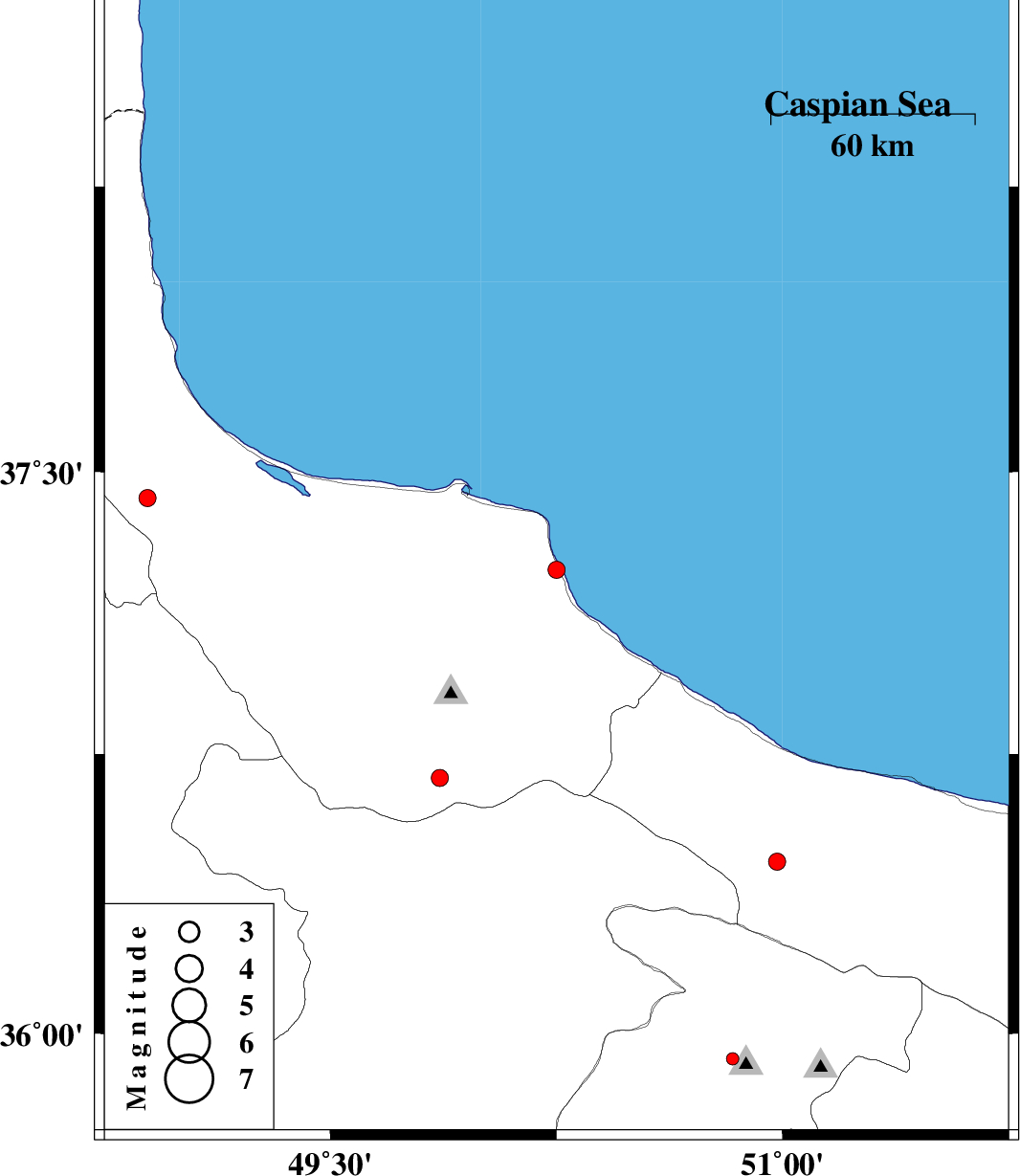
| 2015/10/30 | 22:03:34.4 | 01:33:34.4 | 37.24 | 50.25 | 14 | ML:2.6 | Gilan Province, 12 km North of Rudsar | ||
| 2015/10/09 | 03:27:47.6 | 06:57:47.6 | 36.462 | 50.982 | 14 | ML:2.5 | Mazandaran Province, 40 km South of Tonekabon | ||
| 2015/10/04 | 20:22:49.4 | 23:52:49.4 | 35.931 | 50.834 | 6 | ML:1.9 | Tehran Province, 15 km -East of Hashtgerd | ||
| 2015/10/03 | 15:26:18.2 | 18:56:18.2 | 36.685 | 49.863 | 14 | ML:2.6 | Gilan Province, 52 km South of Siahkal | ||
| 2015/10/03 | 02:08:45.5 | 05:38:45.5 | 35.768 | 49.246 | 14 | ML:1.8 | Ghazvin Province, 42 km South of Abhar | ||
| 2015/10/02 | 04:07:35.1 | 07:37:35.1 | 37.43 | 48.893 | 14 | ML:2.6 | Gilan Province, 24 km -West of Masal |

 IIEES All Rights Reserved