Home / Recent Earthquakes

| Prel. Rep. | Date | Time(UTC) | Time(Local) | Lat. | Lon. | Depth | Mag. | Region | Waveform |
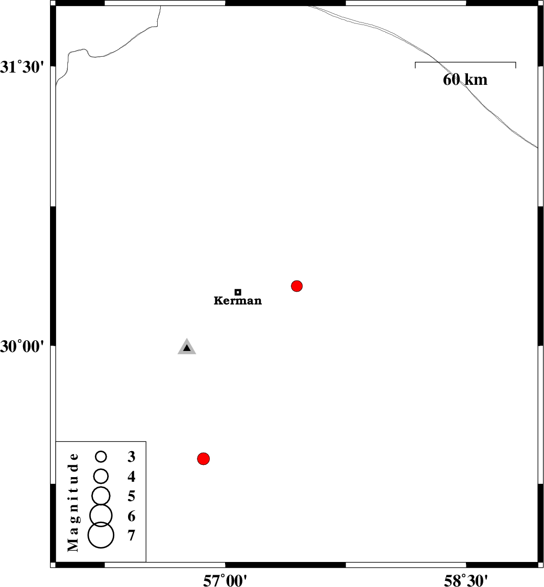
| 2017/08/20 | 01:05:00.5 | 05:35:00.5 | 30.321 | 57.445 | 14 | ML:3.1 | Kerman Province, 35 km -East of Kerman | ||
| 2017/08/14 | 00:13:00.7 | 04:43:00.7 | 29.386 | 56.864 | 15 | ML:3.4 | Kerman Province, 30 km North-East of Baft |