Home / Recent Earthquakes

| Prel. Rep. | Date | Time(UTC) | Time(Local) | Lat. | Lon. | Depth | Mag. | Region | Waveform |
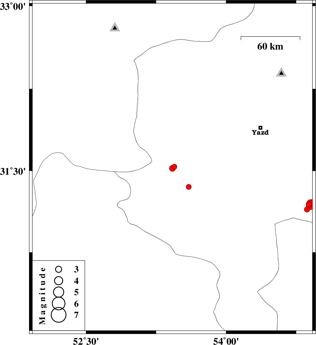
| 2017/10/31 | 19:20:05.7 | 22:50:05.7 | 31.539 | 53.446 | 14 | ML:2.5 | Yazd Province, 48 km North-East of Abarkuh | ||
| 2017/10/31 | 08:32:21.7 | 12:02:21.7 | 31.524 | 53.425 | 14 | ML:3 | Yazd Province, 46 km North-East of Abarkuh | ||
| 2017/10/21 | 03:45:13.4 | 07:15:13.4 | 31.146 | 54.867 | 14 | ML:2.7 | Yazd Province, 63 km South-East of Mehriz | ||
| 2017/10/19 | 02:41:04.7 | 06:11:04.7 | 31.193 | 54.886 | 14 | ML:2.7 | Yazd Province, 60 km South-East of Mehriz | ||
| 2017/10/18 | 15:49:40.9 | 19:19:40.9 | 31.2 | 54.917 | 15 | ML:3 | Yazd Province, 62 km South-East of Mehriz | ||
| 2017/10/18 | 14:55:18.9 | 18:25:18.9 | 31.198 | 54.904 | 14 | ML:2.5 | Yazd Province, 61 km South-East of Mehriz | ||
| 2017/10/18 | 14:37:19.2 | 18:07:19.2 | 31.191 | 54.913 | 15 | ML:5 | Yazd Province, 62 km South-East of Mehriz | ||
| 2017/10/01 | 04:44:34.1 | 08:14:34.1 | 31.353 | 53.6 | 14 | ML:2.6 | Yazd Province, 39 km North-East of Abarkuh |