Home / Recent Earthquakes

| Prel. Rep. | Date | Time(UTC) | Time(Local) | Lat. | Lon. | Depth | Mag. | Region | Waveform |
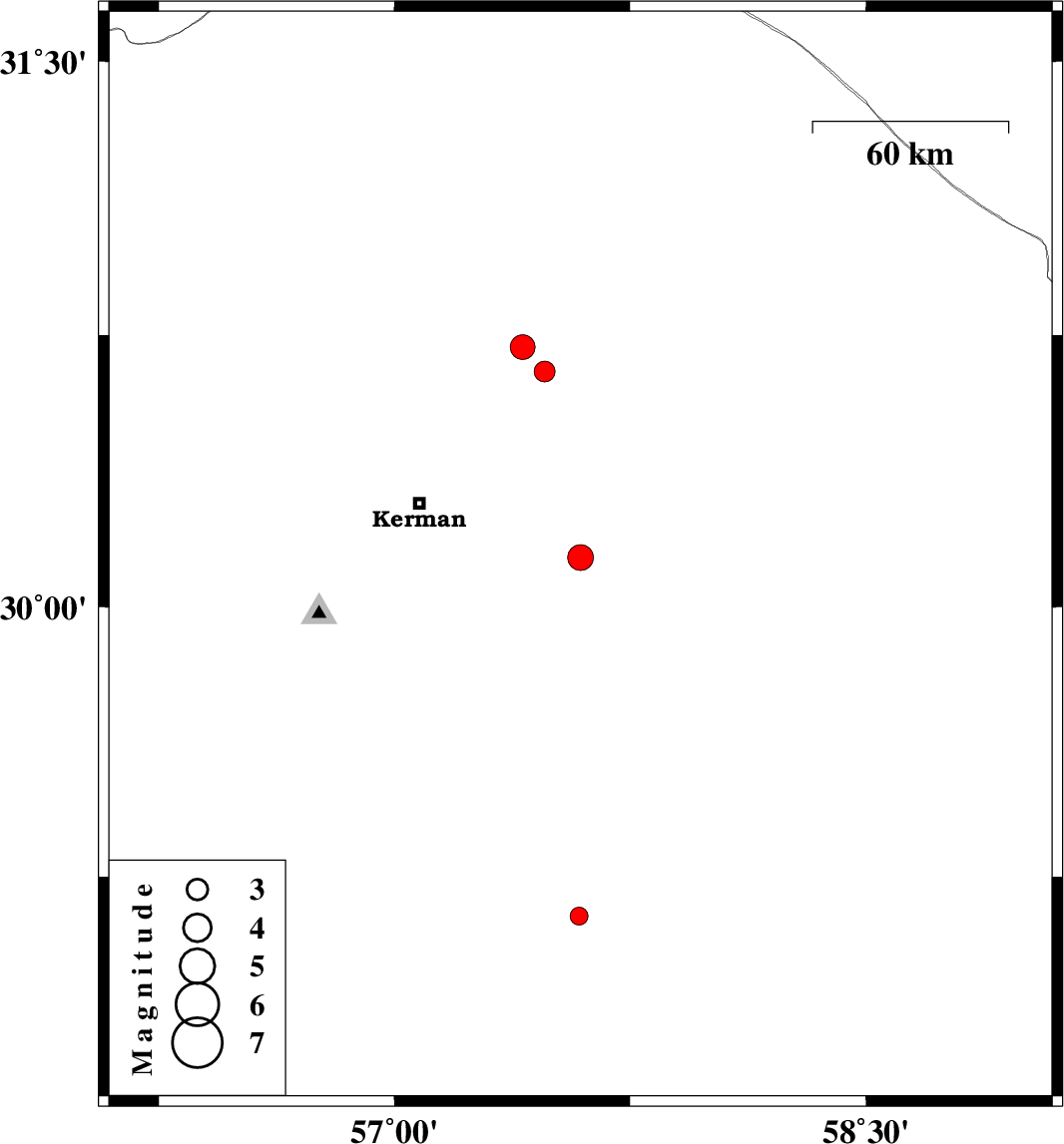
| 2017/11/18 | 07:28:38.4 | 10:58:38.4 | 30.137 | 57.592 | 15 | ML:3.6 | Kerman Province, 52 km South-East of Kerman | ||
| 2017/11/18 | 01:19:39.1 | 04:49:39.1 | 30.65 | 57.478 | 6 | ML:3 | Kerman Province, 56 km North-East of Kerman | ||
| 2017/11/17 | 12:09:04.0 | 15:39:04.0 | 30.717 | 57.408 | 8 | ML:3.5 | Kerman Province, 57 km North-East of Kerman | ||
| 2017/11/12 | 20:43:56.9 | 00:13:56.9 | 29.14 | 57.588 | 14 | ML:2.5 | Kerman Province, 54 km North-West of Jiroft |