Home / Recent Earthquakes

| Prel. Rep. | Date | Time(UTC) | Time(Local) | Lat. | Lon. | Depth | Mag. | Region | Waveform |
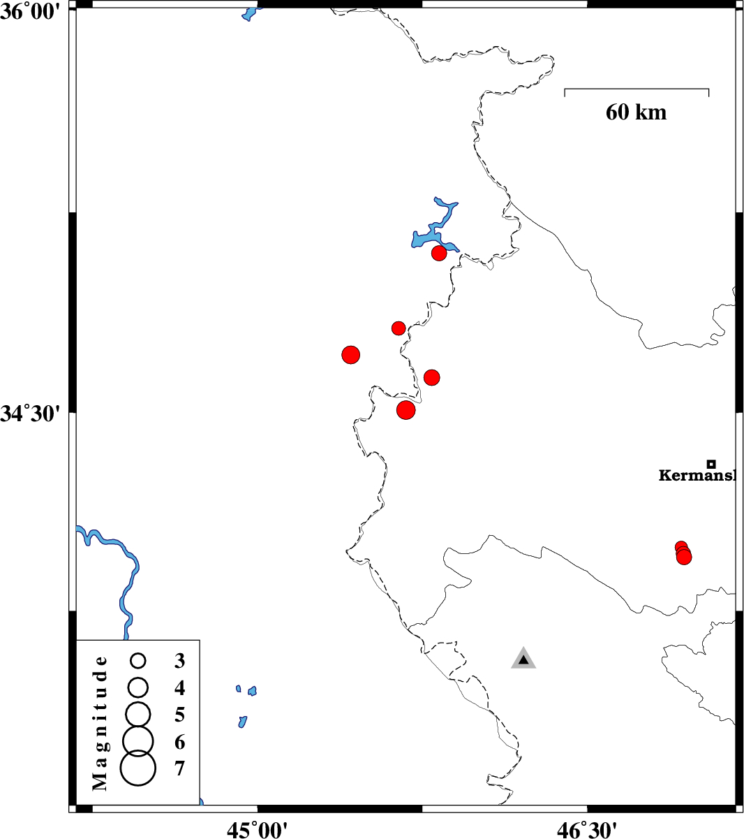
| 2018/01/05 | 06:32:57.8 | 10:02:57.8 | 34.51 | 45.675 | 15 | ML:3.8 | Kermanshah Province, 8 km of Qasr-E-Shirin | ||
| 2018/01/04 | 08:52:11.2 | 12:22:11.2 | 33.955 | 46.941 | 15 | ML:3.1 | Kermanshah Province, 41 km South-West of Kermanshah | ||
| 2018/01/04 | 08:19:11.4 | 11:49:11.4 | 33.968 | 46.938 | 14 | ML:3 | Kermanshah Province, 39 km South-West of Kermanshah | ||
| 2018/01/04 | 08:18:38.6 | 11:48:38.6 | 33.992 | 46.927 | 14 | ML:2.6 | Kermanshah Province, 37 km South-West of Kermanshah | ||
| 2018/01/01 | 19:54:33.8 | 23:24:33.8 | 34.632 | 45.792 | 15 | ML:3.3 | Kermanshah Province, 15 km South of Tazehabad | ||
| 2018/01/01 | 13:49:04.4 | 17:19:04.4 | 34.816 | 45.642 | 15 | ML:2.8 | Iraq, 18 km -West of Tazehabad | ||
| 2017/12/31 | 22:59:49.9 | 02:29:49.9 | 35.097 | 45.826 | 6 | ML:3.1 | Iraq, 37 km North of Tazehabad | ||
| 2017/12/29 | 16:29:47.8 | 19:59:47.8 | 34.717 | 45.425 | 15 | ML:3.7 | Iraq, 27 km North-West of Qasr-E-Shirin |