Home / Recent Earthquakes

| Prel. Rep. | Date | Time(UTC) | Time(Local) | Lat. | Lon. | Depth | Mag. | Region | Waveform |
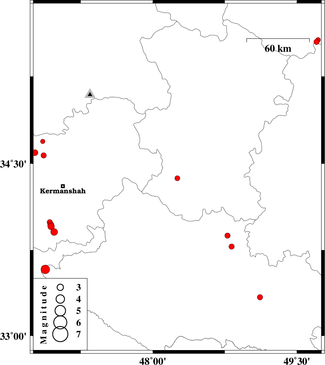
| 2018/01/26 | 00:38:32.7 | 04:08:32.7 | 34.373 | 48.256 | 15 | ML:2.4 | Hamedan Province, 22 km North-West of Nahavand | ||
| 2018/01/25 | 12:43:07.5 | 16:13:07.5 | 33.876 | 48.778 | 15 | ML:2.5 | Lorestan Province, 3 km of Borujerd | ||
| 2018/01/23 | 03:45:15.4 | 07:15:15.4 | 33.582 | 46.881 | 15 | ML:4.1 | Lorestan Province, 42 km -East of Ilam | ||
| 2018/01/21 | 15:05:55.5 | 18:35:55.5 | 34.691 | 46.855 | 8 | ML:2.1 | Kermanshah Province, 16 km South of Kamyaran | ||
| 2018/01/11 | 00:45:45.7 | 04:15:45.7 | 34.571 | 46.864 | 6 | ML:2.6 | Kermanshah Province, 28 km South of Kamyaran | ||
| 2018/01/10 | 05:33:22.2 | 09:03:22.2 | 34.595 | 46.774 | 7 | ML:2.8 | Kermanshah Province, 29 km South-West of Kamyaran | ||
| 2018/01/08 | 17:45:09.3 | 21:15:09.3 | 33.908 | 46.974 | 14 | ML:3.3 | Kermanshah Province, 45 km South of Kermanshah | ||
| 2018/01/04 | 08:52:11.2 | 12:22:11.2 | 33.955 | 46.941 | 15 | ML:3.1 | Kermanshah Province, 41 km South-West of Kermanshah | ||
| 2018/01/04 | 08:19:11.4 | 11:49:11.4 | 33.968 | 46.938 | 14 | ML:3 | Kermanshah Province, 39 km South-West of Kermanshah | ||
| 2018/01/04 | 08:18:38.6 | 11:48:38.6 | 33.992 | 46.927 | 14 | ML:2.6 | Kermanshah Province, 37 km South-West of Kermanshah | ||
| 2018/01/04 | 04:40:17.9 | 08:10:17.9 | 33.781 | 48.822 | 9 | ML:2.6 | Lorestan Province, 14 km South of Borujerd | ||
| 2018/01/03 | 00:29:46.3 | 03:59:46.3 | 35.545 | 49.706 | 14 | ML:2.5 | Ghazvin Province, 58 km South of Takestan | ||
| 2018/01/02 | 22:59:29.4 | 02:29:29.4 | 35.561 | 49.722 | 14 | ML:2.3 | Ghazvin Province, 56 km South of Takestan | ||
| 2017/12/31 | 05:00:35.4 | 08:30:35.4 | 33.338 | 49.117 | 14 | ML:2.6 | Lorestan Province, 17 km South of Dorud |