Home / Recent Earthquakes

| Prel. Rep. | Date | Time(UTC) | Time(Local) | Lat. | Lon. | Depth | Mag. | Region | Waveform |
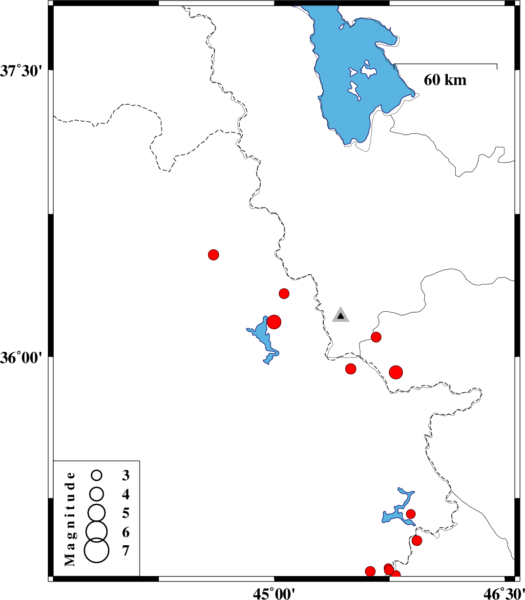
| 2018/02/20 | 10:01:24.5 | 13:31:24.5 | 36.332 | 45.064 | 17 | ML:3 | Iraq, 42 km South of Piranshahr | ||
| 2018/02/19 | 21:31:40.5 | 01:01:40.5 | 36.183 | 44.999 | 15 | ML:4.1 | Iraq, 42 km -West of Sardasht | ||
| 2018/02/17 | 03:21:20.5 | 06:51:20.5 | 34.865 | 45.747 | 14 | ML:2.8 | Iraq, 14 km North of Tazehabad | ||
| 2018/02/14 | 04:50:47.0 | 08:20:47.0 | 35.165 | 45.888 | 16 | ML:2.7 | Iraq, 45 km North of Tazehabad | ||
| 2018/02/14 | 00:48:49.2 | 04:18:49.2 | 34.876 | 45.742 | 15 | ML:2.6 | Iraq, 15 km North of Tazehabad | ||
| 2018/02/03 | 21:44:54.3 | 01:14:54.3 | 36.536 | 44.605 | 14 | ML:3.1 | Iraq, 51 km South-West of Piranshahr | ||
| 2018/02/02 | 17:17:24.7 | 20:47:24.7 | 34.839 | 45.792 | 15 | ML:2.7 | Kermanshah Province, 9 km of Tazehabad | ||
| 2018/01/31 | 23:44:20.3 | 03:14:20.3 | 35.023 | 45.928 | 6 | ML:2.9 | Kermanshah Province, 30 km North of Tazehabad | ||
| 2018/01/30 | 21:40:12.8 | 01:10:12.8 | 35.936 | 45.498 | 14 | ML:3.1 | Iraq, 25 km South of Sardasht | ||
| 2018/01/28 | 10:13:05.7 | 13:43:05.7 | 34.858 | 45.625 | 14 | ML:3 | Iraq, 22 km -West of Tazehabad | ||
| 2018/01/22 | 03:04:56.8 | 06:34:56.8 | 36.104 | 45.662 | 14 | ML:3 | Azarbaijan Gharbi Province, 19 km -East of Sardasht | ||
| 2018/01/21 | 09:07:29.8 | 12:37:29.8 | 35.918 | 45.792 | 14 | ML:4 | Kurdistan Province, 12 km of Baneh |