
| Prel. Rep. | Date | Time(UTC) | Time(Local) | Lat. | Lon. | Depth | Mag. | Region | Waveform |
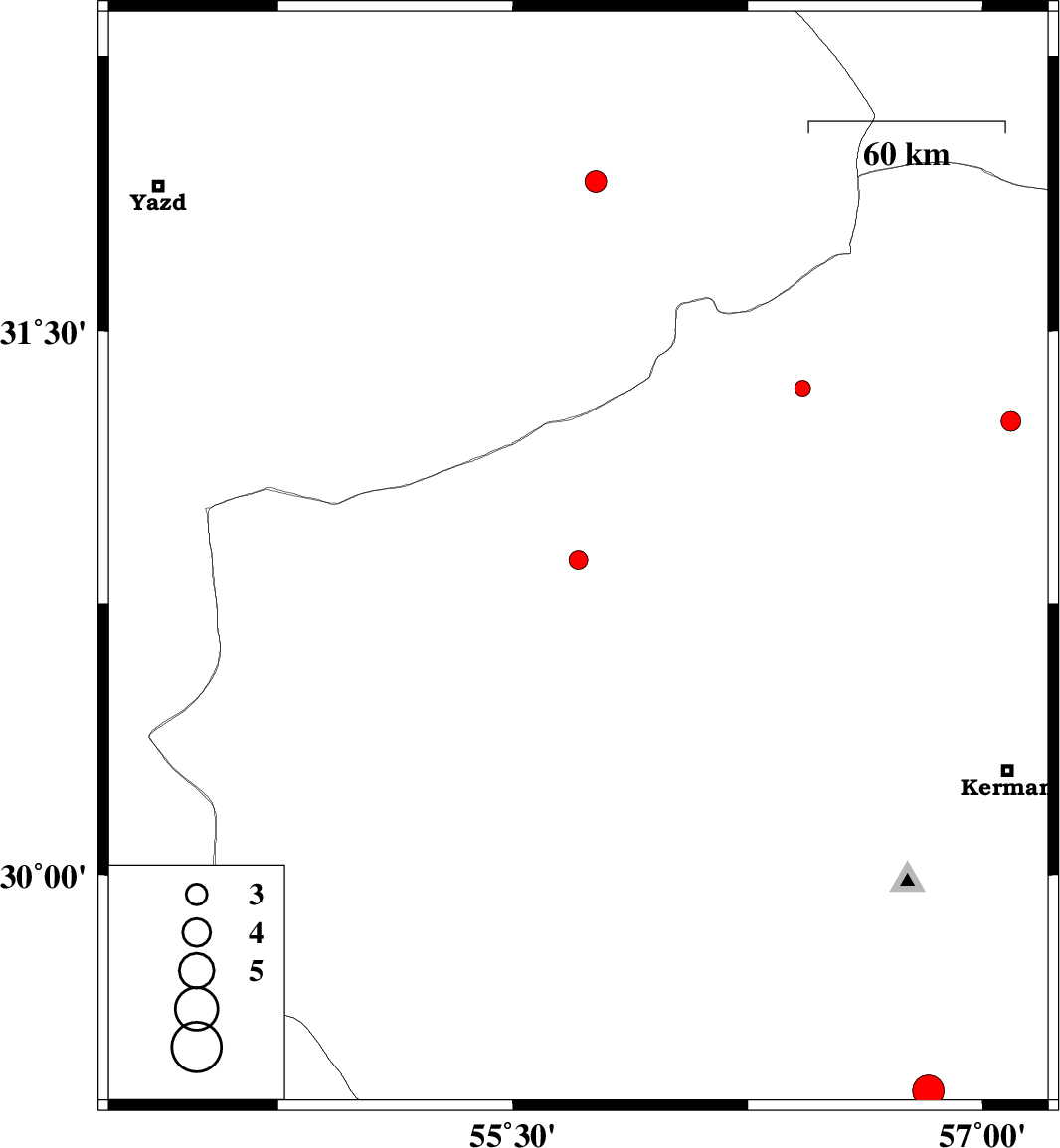
| 2018/09/04 | 14:18:53.2 | 18:48:53.2 | 30.872 | 55.709 | 14 | ML:2.7 | Kerman Province, 59 km North-West of Rafsanjan | ||
| 2018/09/03 | 17:44:48.5 | 22:14:48.5 | 31.252 | 57.091 | 18 | ML:2.8 | Kerman Province, 27 km -East of Ravar | ||
| 2018/08/28 | 02:04:48.7 | 06:34:48.7 | 31.908 | 55.764 | 14 | ML:3.1 | Yazd Province, 48 km North-East of Bafq | ||
| 2018/08/23 | 05:18:59.1 | 09:48:59.1 | 29.397 | 56.827 | 14 | ML:4.5 | Kerman Province, 28 km North-East of Baft | ||
| 2018/08/21 | 01:23:57.7 | 05:53:57.7 | 31.343 | 56.425 | 18 | ML:2.2 | Kerman Province, 38 km -West of Ravar |

 IIEES All Rights Reserved