Home / Recent Earthquakes

| Prel. Rep. | Date | Time(UTC) | Time(Local) | Lat. | Lon. | Depth | Mag. | Region | Waveform |
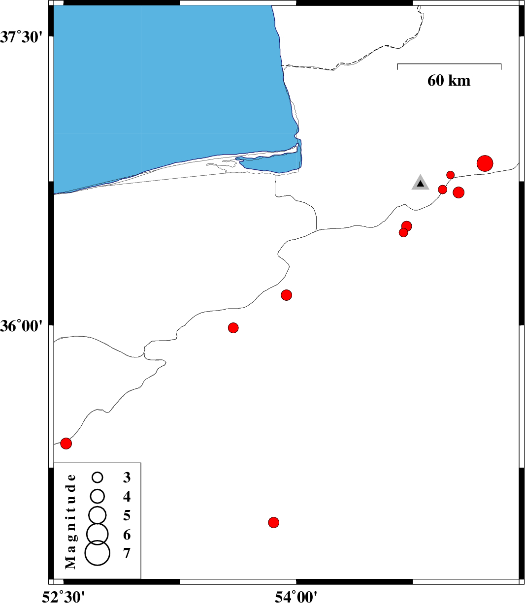
| 2018/09/11 | 23:25:45.2 | 03:55:45.2 | 36.158 | 53.936 | 14 | ML:3.1 | Semnan Province, 37 km -West of Damghan | ||
| 2018/09/04 | 12:58:02.9 | 17:28:02.9 | 34.959 | 53.854 | 14 | ML:3.1 | Semnan Province, 79 km South-East of Semnan | ||
| 2018/09/02 | 05:17:10.3 | 09:47:10.3 | 35.378 | 52.516 | 15 | ML:3.2 | Semnan Province, 24 km North-East of Garmsar | ||
| 2018/08/21 | 02:04:00.1 | 06:34:00.1 | 35.986 | 53.593 | 14 | ML:3 | Semnan Province, 50 km North-East of Semnan | ||
| 2018/08/17 | 16:39:48.1 | 21:09:48.1 | 36.484 | 54.691 | 14 | ML:2.5 | Semnan Province, 26 km -West of Shahrud | ||
| 2018/08/16 | 15:40:41.9 | 20:10:41.9 | 36.784 | 54.993 | 15 | ML:2.2 | Golestan Province, 17 km South-East of Ali Abad | ||
| 2018/08/16 | 07:07:39.7 | 11:37:39.7 | 36.518 | 54.711 | 14 | ML:3 | Semnan Province, 25 km -West of Shahrud | ||
| 2018/08/16 | 06:41:51.0 | 11:11:51.0 | 36.843 | 55.216 | 15 | ML:4.7 | Golestan Province, 20 km South of Ramian | ||
| 2018/08/13 | 04:02:43.6 | 08:32:43.6 | 36.693 | 55.046 | 15 | ML:3.3 | Semnan Province, 31 km North of Shahrud | ||
| 2018/08/12 | 00:04:52.6 | 04:34:52.6 | 36.708 | 54.942 | 15 | ML:2.6 | Golestan Province, 23 km South of Ali Abad |