| Prel. Rep. | Date | Time(UTC) | Time(Local) | Lat. | Lon. | Depth | Mag. | Region | Waveform |
|
|
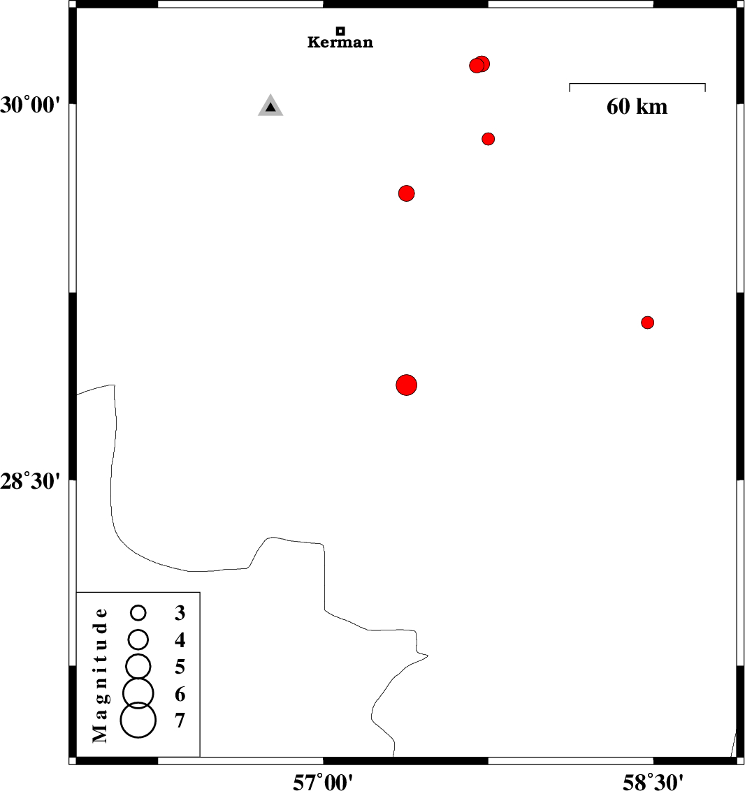
2018/09/30
|
13:23:36.6
|
16:53:36.6
| 28.88 | 57.378 | 15 |
ML:4.2
|
Kerman Province, 42 km North-West of Jiroft | |
|
|
2018/09/26
|
01:39:50.2
|
05:09:50.2
| 29.13 | 58.474 | 14 |
ML:2.5
|
Kerman Province, 12 km -East of Bam | |
|
|
2018/09/18
|
02:04:28.4
|
06:34:28.4
| 29.645 | 57.378 | 14 |
ML:3.3
|
Kerman Province, 77 km South-East of Kerman | |
|
|
2018/09/17
|
03:44:18.9
|
08:14:18.9
| 28.007 | 56.269 | 16 |
ML:3.4
|
Hormozgan Province, 49 km South-East of Hajiabad | |
|
|
2018/09/16
|
21:34:36.2
|
02:04:36.2
| 27.993 | 56.296 | 16 |
ML:3.4
|
Hormozgan Province, 52 km South-East of Hajiabad | |
|
|
2018/09/16
|
17:10:57.5
|
21:40:57.5
| 28.008 | 56.339 | 14 |
ML:3.3
|
Hormozgan Province, 54 km South-East of Hajiabad | |
|
|
2018/09/10
|
01:33:31.8
|
06:03:31.8
| 27.7 | 56.355 | 14 |
ML:2.8
|
Hormozgan Province, 58 km North of Bandar-e abbas | |
|
|
2018/09/02
|
19:00:44.6
|
23:30:44.6
| 30.151 | 57.697 | 14 |
ML:2.9
|
Kerman Province, 61 km South-East of Kerman | |
|
|
2018/09/02
|
18:54:25.8
|
23:24:25.8
| 30.158 | 57.72 | 14 |
ML:3.3
|
Kerman Province, 63 km South-East of Kerman | |
|
|
2018/09/01
|
00:27:01.1
|
04:57:01.1
| 29.86 | 57.75 | 14 |
ML:2.5
|
Kerman Province, 80 km South-East of Kerman | |