| Prel. Rep. | Date | Time(UTC) | Time(Local) | Lat. | Lon. | Depth | Mag. | Region | Waveform |
|
|
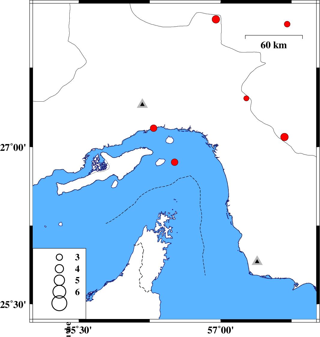
2018/11/19
|
21:31:14.0
|
01:01:14.0
| 26.854 | 56.513 | 15 |
ML:3.2
|
Persian Gulf, 27 km South-East of Qeshm | |
|
|
2018/11/12
|
21:27:04.8
|
00:57:04.8
| 28.158 | 57.704 | 18 |
ML:2.8
|
Kerman Province, 23 km North of Kahnuj | |
|
|
2018/11/11
|
10:36:05.7
|
14:06:05.7
| 27.177 | 56.291 | 15 |
ML:3.3
|
Hormozgan Province, 1 km of Bandar-e abbas | |
|
|
2018/11/06
|
04:14:42.8
|
07:44:42.8
| 28.203 | 56.949 | 14 |
ML:3.7
|
Hormozgan Province, 78 km North-West of Kahnuj | |
|
|
2018/10/24
|
15:13:40.2
|
18:43:40.2
| 27.093 | 57.676 | 7 |
ML:3.6
|
Kerman Province, 40 km South-East of Manujan | |
|
|
2018/10/20
|
16:05:45.3
|
19:35:45.3
| 27.46 | 57.272 | 14 |
ML:2.5
|
Hormozgan Province, 5 km of Dehbarez | |