
| Prel. Rep. | Date | Time(UTC) | Time(Local) | Lat. | Lon. | Depth | Mag. | Region | Waveform |
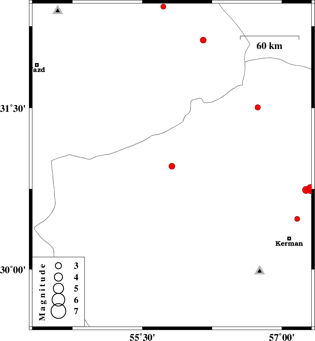
| 2019/01/26 | 10:14:13.8 | 13:44:13.8 | 30.961 | 55.818 | 14 | ML:3 | Kerman Province, 64 km North-West of Rafsanjan | ||
| 2019/01/21 | 18:49:01.6 | 22:19:01.6 | 30.761 | 57.305 | 14 | ML:3.2 | Kerman Province, 57 km North-East of Kerman | ||
| 2019/01/20 | 23:36:09.3 | 03:06:09.3 | 30.471 | 57.165 | 14 | ML:2.6 | Kerman Province, 22 km North of Kerman | ||
| 2019/01/15 | 23:52:30.7 | 03:22:30.7 | 30.741 | 57.259 | 14 | ML:3.5 | Kerman Province, 53 km North-East of Kerman | ||
| 2019/01/15 | 23:05:09.3 | 02:35:09.3 | 31.505 | 56.741 | 14 | ML:2.7 | Kerman Province, 27 km North of Ravar | ||
| 2019/01/14 | 09:48:27.2 | 13:18:27.2 | 32.429 | 55.726 | 14 | ML:2.6 | Yazd Province, 97 km North-East of Bafq | ||
| 2019/01/04 | 19:07:37.7 | 22:37:37.7 | 32.123 | 56.154 | 14 | ML:3 | Yazd Province, 92 km North-East of Bafq | ||
| 2018/12/30 | 06:13:18.3 | 09:43:18.3 | 30.732 | 57.306 | 14 | ML:2.8 | Kerman Province, 54 km North-East of Kerman |

 IIEES All Rights Reserved