
| Prel. Rep. | Date | Time(UTC) | Time(Local) | Lat. | Lon. | Depth | Mag. | Region | Waveform |
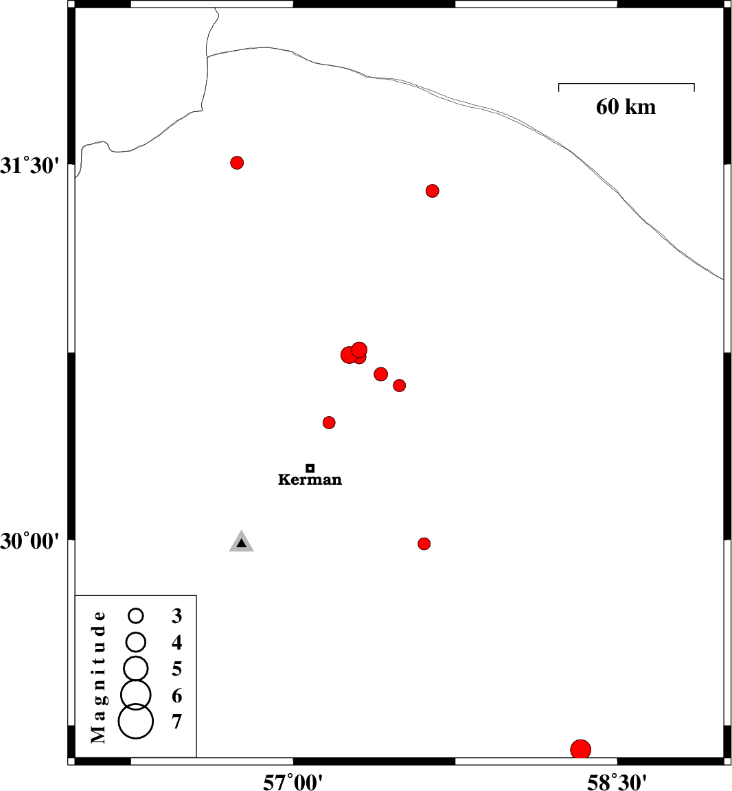
| 2019/01/28 | 13:39:16.1 | 17:09:16.1 | 30.619 | 57.491 | 14 | ML:2.6 | Kerman Province, 54 km North-East of Kerman | ||
| 2019/01/22 | 20:48:07.9 | 00:18:07.9 | 31.394 | 57.643 | 15 | ML:2.7 | Kerman Province, 80 km North-East of Ravar | ||
| 2019/01/21 | 18:49:01.6 | 22:19:01.6 | 30.761 | 57.305 | 14 | ML:3.2 | Kerman Province, 57 km North-East of Kerman | ||
| 2019/01/20 | 23:36:09.3 | 03:06:09.3 | 30.471 | 57.165 | 14 | ML:2.6 | Kerman Province, 22 km North of Kerman | ||
| 2019/01/15 | 23:52:30.7 | 03:22:30.7 | 30.741 | 57.259 | 14 | ML:3.5 | Kerman Province, 53 km North-East of Kerman | ||
| 2019/01/15 | 23:05:09.3 | 02:35:09.3 | 31.505 | 56.741 | 14 | ML:2.7 | Kerman Province, 27 km North of Ravar | ||
| 2019/01/14 | 01:27:13.9 | 04:57:13.9 | 29.151 | 58.329 | 14 | ML:4.2 | Kerman Province, 5 km of Bam | ||
| 2019/01/13 | 15:32:19.0 | 19:02:19.0 | 29.984 | 57.605 | 14 | ML:2.5 | Kerman Province, 61 km South-East of Kerman | ||
| 2019/01/02 | 04:20:40.4 | 07:50:40.4 | 30.664 | 57.406 | 14 | ML:2.8 | Kerman Province, 52 km North-East of Kerman | ||
| 2018/12/30 | 06:13:18.3 | 09:43:18.3 | 30.732 | 57.306 | 14 | ML:2.8 | Kerman Province, 54 km North-East of Kerman |

 IIEES All Rights Reserved